12 days in Thailand 1/7- 1/18/2025
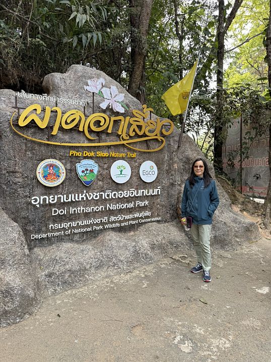
Day 5-Pha Dok Siao Nature Tail -1/11/2025
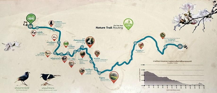
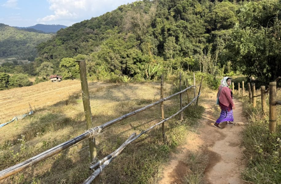
Our next destination is the Pha Dok Sia Nature Trail.
The trail is roughly 2 to 2.5 kilometers (about 1.2–1.5 miles). It’s not especially long, but it feels rich because of everything we see along the way.
 |
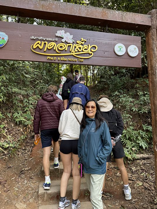 |
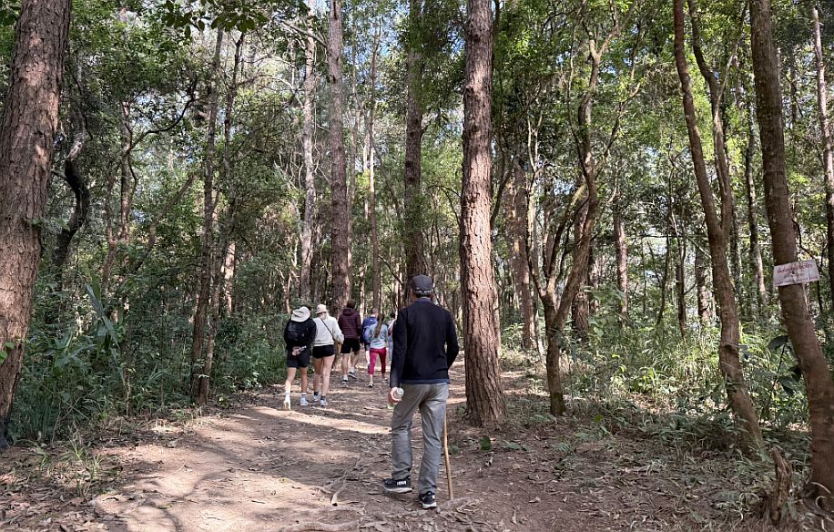
Before starting, I noticed that our group needed to be joined by a local villager guide. That’s intentional. The park requires this system to support the local community (especially the Karen hill tribe), which provide jobs and income directly tied to conservation.
Even though your local guide didn’t speak English, her presence is essential as she knows the land intimately, and your main guide helps bridge the language and share the stories.
 |
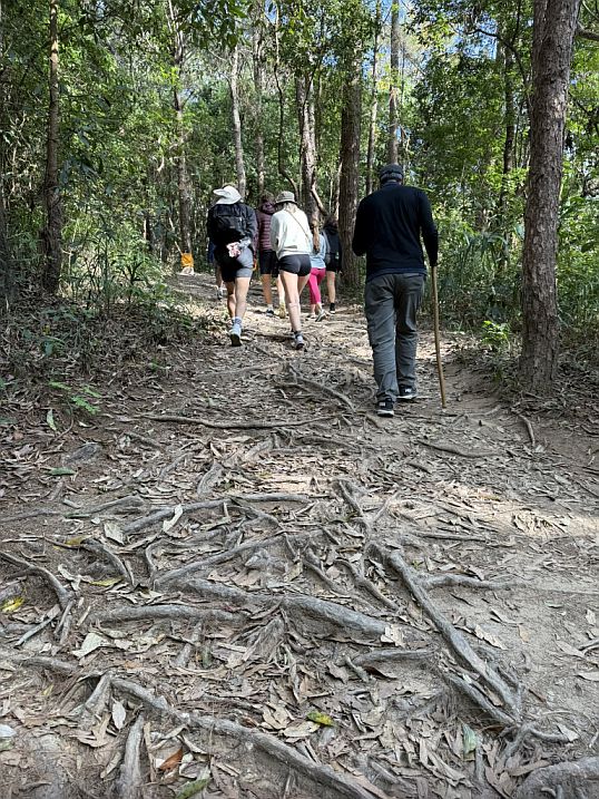 |
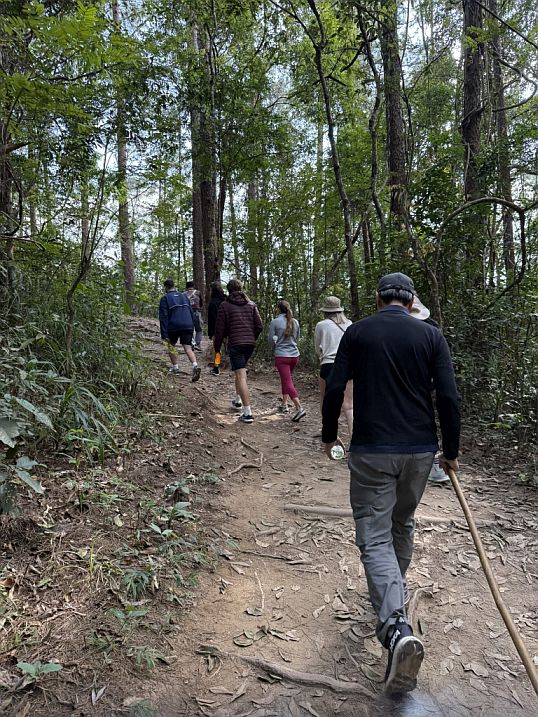
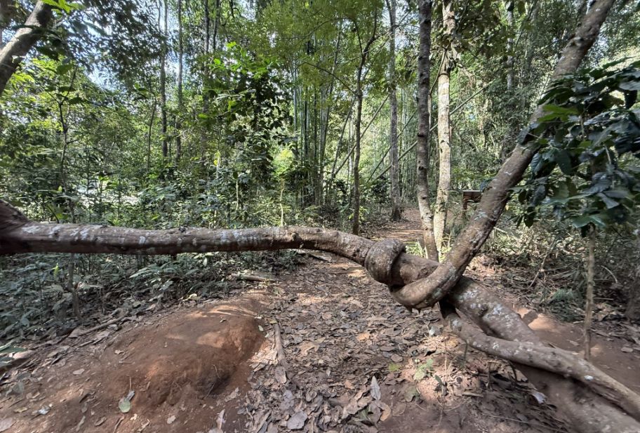
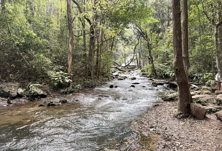
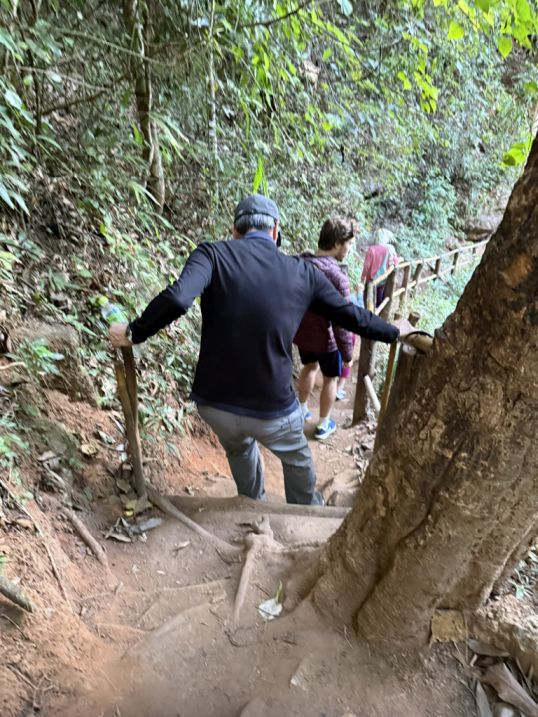
The hike begins under a canopy of trees, where the light filters softly through the leaves. The terrain is manageable, but we quickly realize it requires attention.
For many decades, remote mountain communities, including Karen, Hmong, and other hill tribes relied on opium cultivation as a primary source of income. The terrain is steep, the soil can be difficult, and these villages were often isolated with limited access to markets. In the late 1960s and 1970s, King Bhumibol Adulyadej recognized that simply banning opium wouldn’t work. The villagers depended on it to survive. So instead of enforcement alone, he introduced a long-term solution through what became the Royal Project (Royal Project Foundation). The idea was simple, replace opium with sustainable, profitable crops. Over time, this transformed villages like Ban Mae Klang Luang into agricultural communities that could earn stable, legal income. Today, when you walk past those plots and small farms along your hike, you’re actually seeing the result of that transformation.
 |
 |
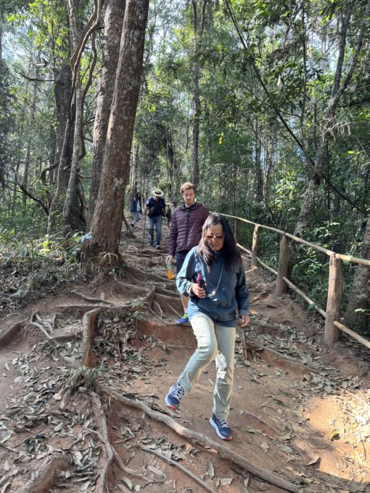
The ground is uneven, with tree roots weaving across the trail, forcing people to watch each step. It slows you down in a good way, and people become more aware of their surroundings.
 |
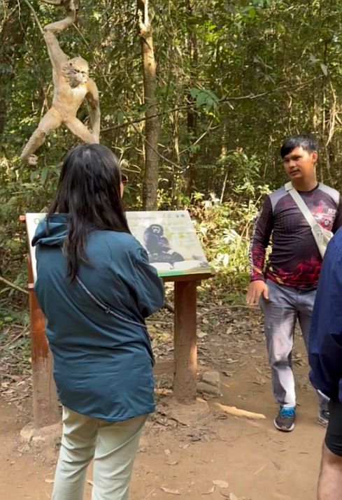 |
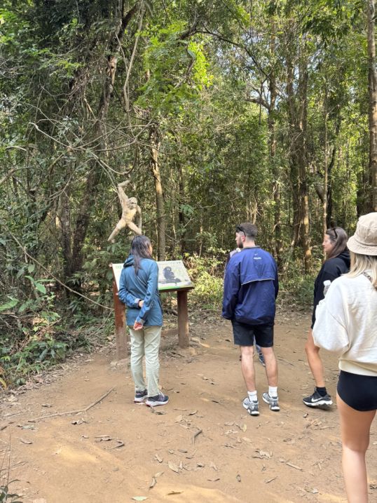
Our tour guide explaining the forests around Doi Inthanon are home to several native primates, most commonly Macaques and occasionally leaf monkeys/Langurs. These species have lived in these forests for centuries, but their populations declined over time. When Doi Inthanon National Park was established in 1972, one of its key goals was to protect wildlife and restore habitats. Today, monkeys in this region are not domesticated or part of tourist attractions, they are wild and protected. Their presence is actually a sign that the forest is relatively healthy.
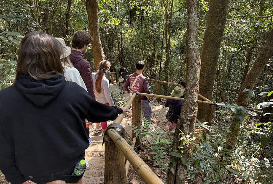
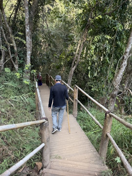
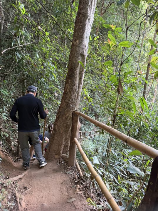
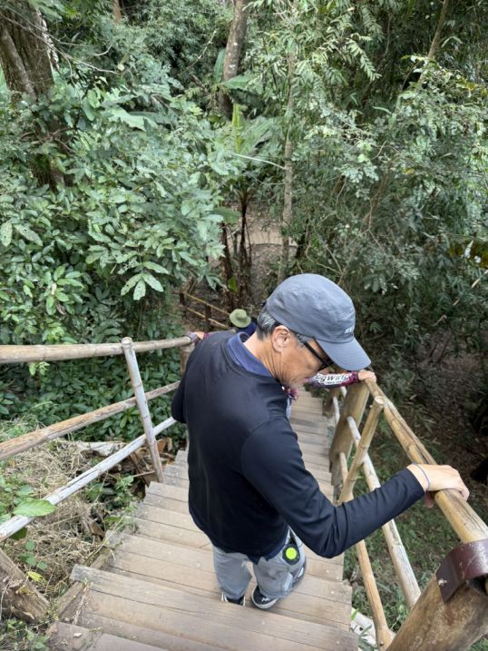
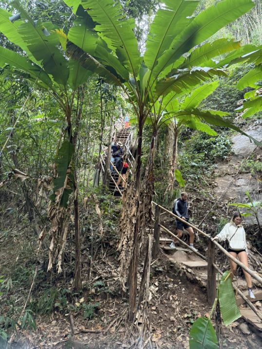
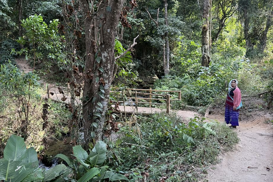
As the forest trail continued, the path began to slope more steeply downward, and the terrain changed again. The dirt gave way to a series of wooden steps, carefully laid out along the hillside, with simple bamboo railings to guide the way. Walking down, step by step, you could feel the descent more clearly now, the air slightly cooler, the sound of water somewhere below becoming more present.
 |
 |
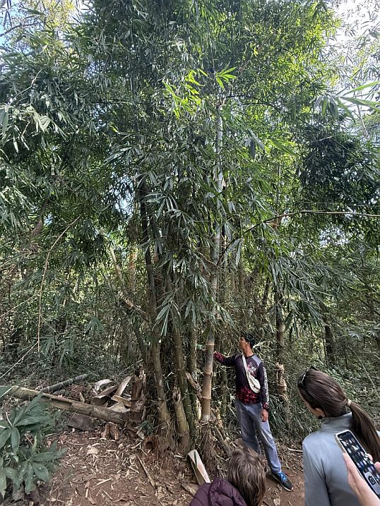
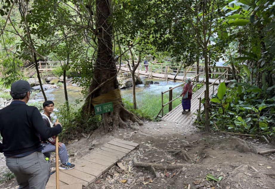
At the bottom, the trail leveled out into a flatter trail. and our guide paused to gather everyone. Here, the focus shifted from walking to understanding the environment around us. He began talking about bamboo, which was all around you. In this region, bamboo is incredibly important to local communities as it use for building homes, fences, made into baskets, tools, and even cooking utensils. It’s one of those materials that is both practical and sustainable, growing quickly and replenishing itself naturally.
On the right is “ordained trees.”, I will talk more about it a bit later.
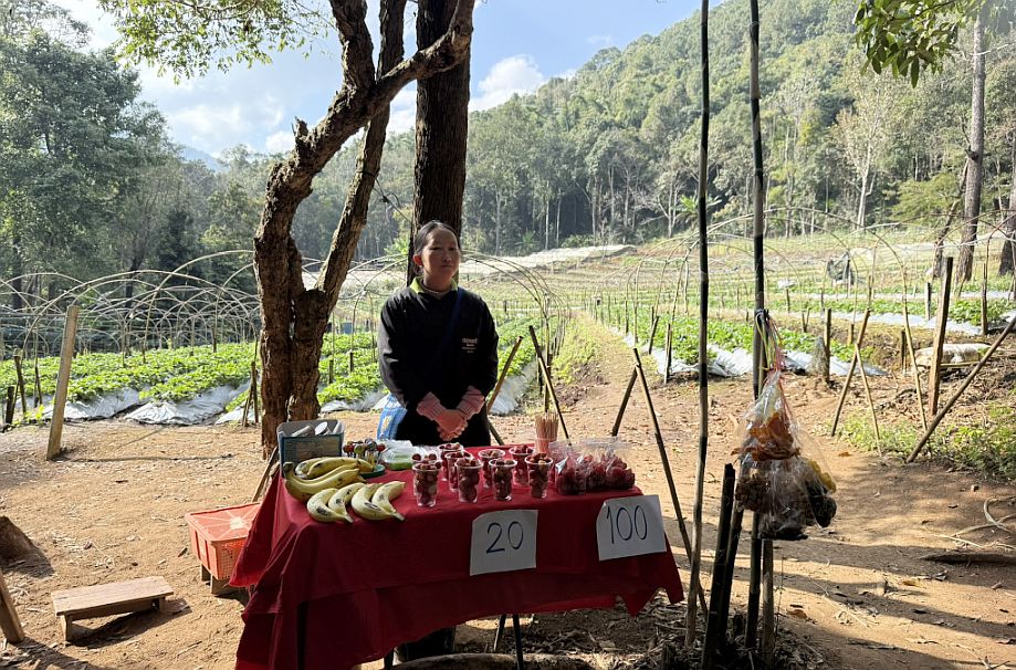
At one point, we passed a small, simple setup where a local woman is selling snacks and drinks. It feels informal and authentic, just a pause point along the trail.
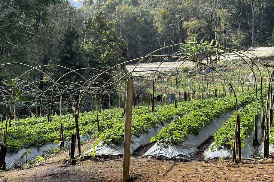
In the background, we can see a plot where villagers are growing vegetables. It’s a reminder that this isn’t just a park, it’s also a living landscape, where people and nature coexist.
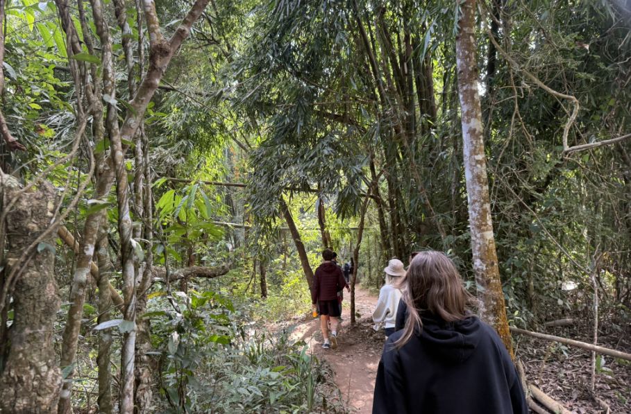
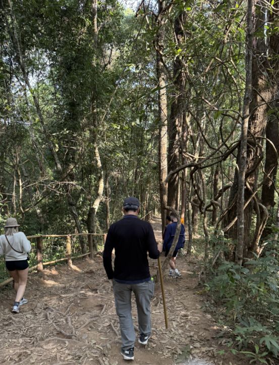
We continued our walk in the forest
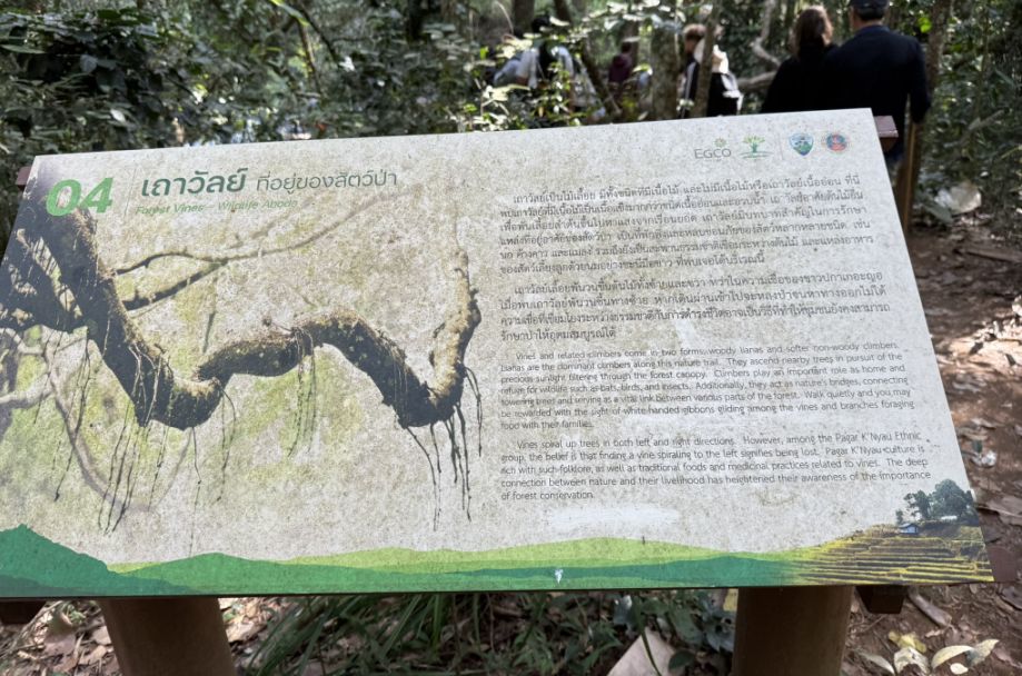
Further along, we came across an interpretive panel about forest vines and wildlife habitat. Looking around, you could see what it meant.
Then we saw twisting branches and vines wrapping around trees. These tangled, almost sculptural branches we noticed aren’t just visually interesting, they form part of a living ecosystem, providing food, protection, and movement for wildlife.
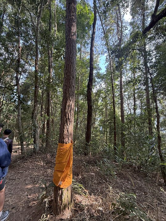
As we continued, we noticed again those trees wrapped in bright orange cloth, similar to a monk’s robe. These are known as “ordained trees.” In Thai Buddhist tradition, monks symbolically wrap trees in saffron cloth to mark them as sacred. Once “ordained,” they are protected, people will not cut them down. It’s a powerful example of how spiritual belief is used to protect the forest.

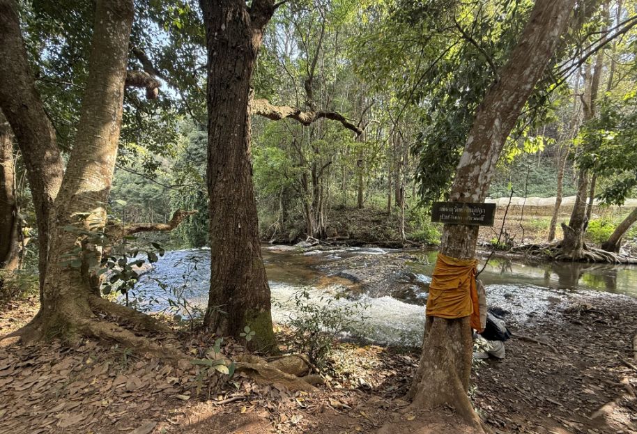
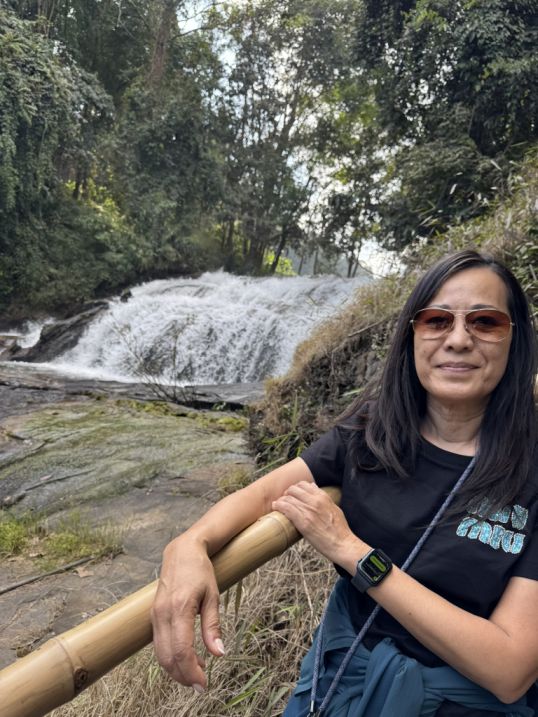
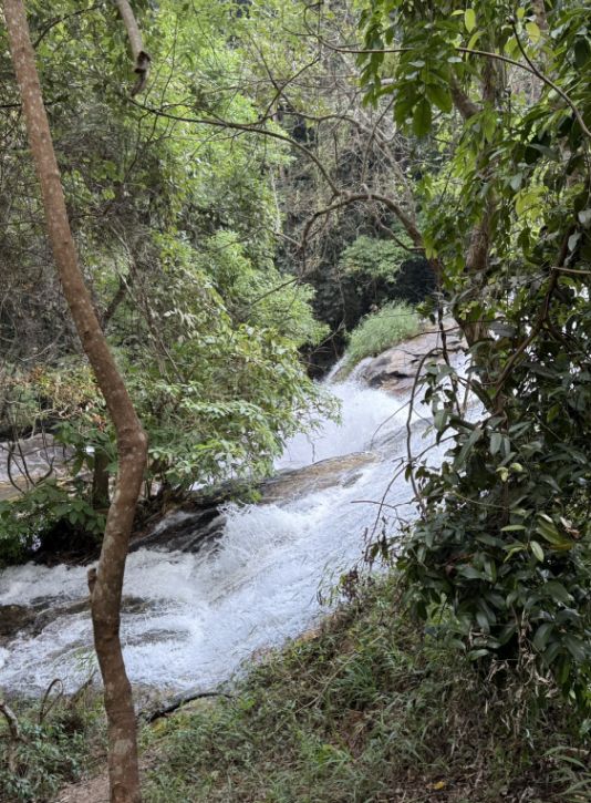
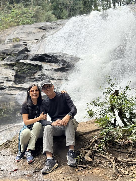
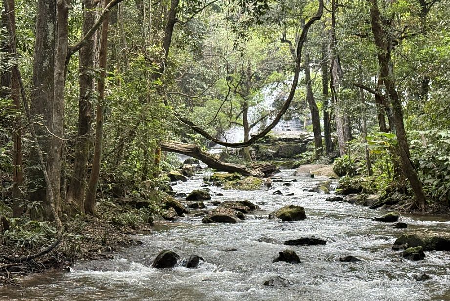
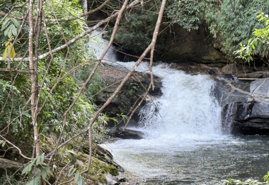
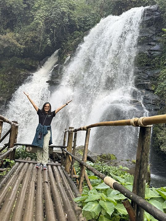
The sound of water grows louder until you reach the waterfall which one of the highlights of the trail. It feels tucked into the forest, almost hidden until we arrived.
Then, along the edge of the walkway, we caught our first glimpse of the waterfall, a section of water slipping down beside the path, almost quietly, as if it were just beginning its descent.
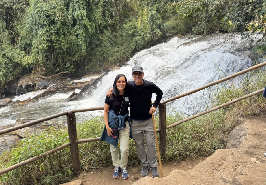
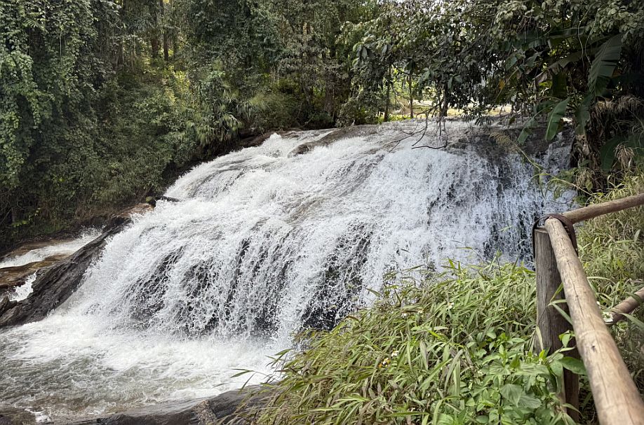
But as you continued down the wooden pathway, the view opened up, and the waterfall revealed itself more fully.
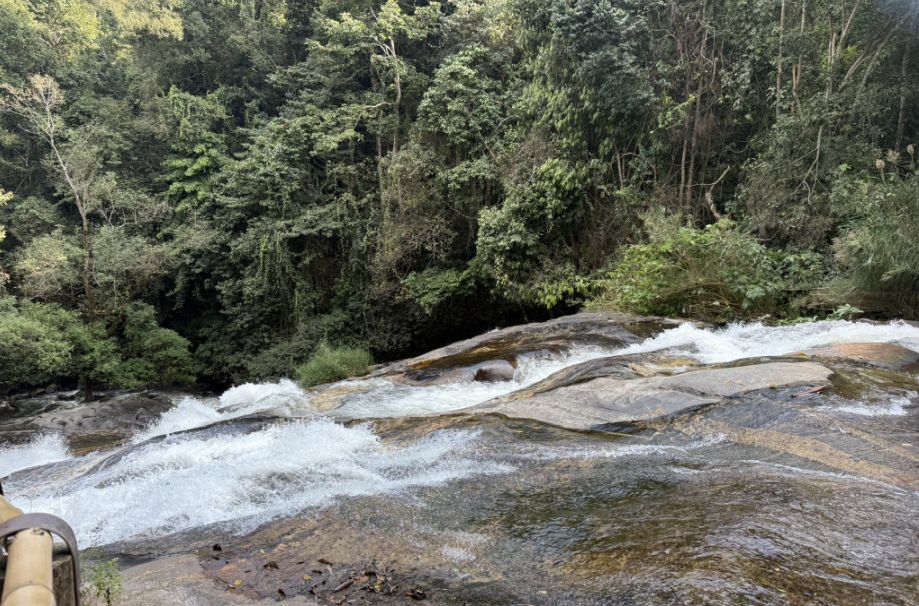
Further along, the flow changed. There was a brief stretch where the water flattened, spreading gently across a rocky surface before gathering itself again.
 |
 |
We kept walking alongside the waterfall, the trail almost hugging the waterfall, letting people experience it from different angles.
 |
 |
The sound followed us the entire way, sometimes loud and rushing, sometimes softer, depending on how the water moved.
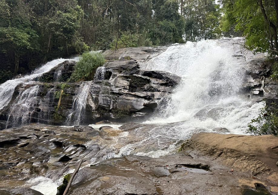
Then it dropped once more, this time over larger, more dramatic creating a stronger cascade. The contrast between the gentle flow and the more powerful descent made each section feel distinct.
This the second drop, where the waterfall cascaded down again, framed by the forest around it.
 |
 |
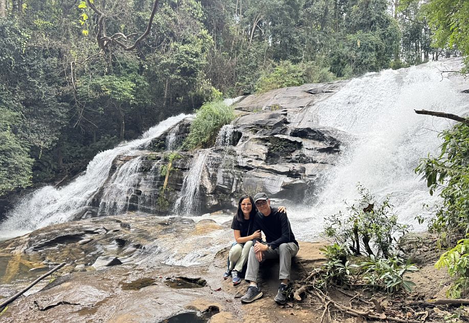
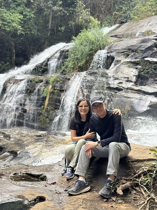
Here, there was a small area where people could sit, with the waterfall just behind, a natural backdrop that felt both peaceful and dramatic at the same time.
It’s the kind of place where you instinctively pause, not just for photos, but to take in the moment. The combination of sound, movement, and cool mountain air makes it one of the most memorable parts of the hike.
Just when we thought the waterfall had revealed everything, the trail reminded us that it still had more to offer. As we continued walking, the water never really left us.
It transformed, no longer just a dramatic cascade, but now flowing like a narrow river, weaving its way through the forest. When I turned back, I could still catch glimpses of the earlier falls, partially hidden behind trees, the water slipping through the greenery as if it were tucked away from view. It gave the sense that the waterfall wasn’t a single moment, but a continuous journey down the mountain.
 |
 |
Then the trail shifted again. We descended a set of steep dirt steps, a bit more rugged.
At the bottom, we were surprised to find the water still rushing, threading its way between large rocks, and moving quickly and purposefully downhill.
From there, the path became even more dramatic.
 |
 |
A series of steep wooden stairs took us further down, deeper into the valley. With each step, the sound of the water grew louder again, echoing through the trees.
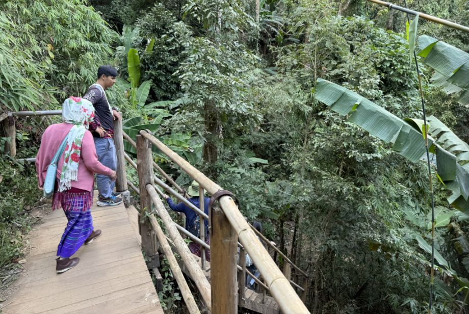
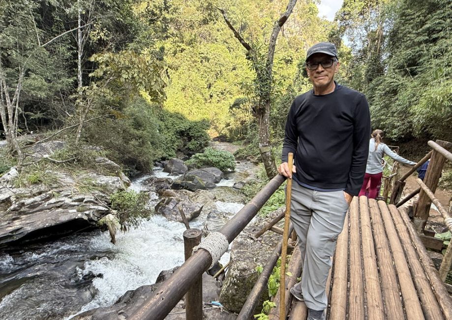
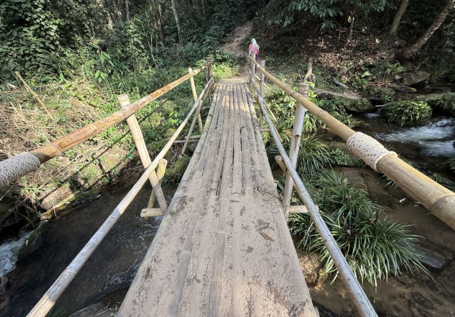
And then we reached the bamboo bridges, simple structures that crossed over the flowing water.
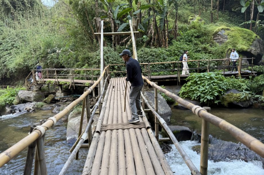
Walking across the bamboo bridge, we could feel how close you were now, almost at the level of the stream itself.
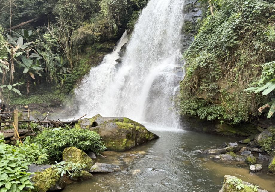
At the end of the bridge, the view opened, and there it was another waterfall, taller and more striking.

This one felt more hidden, almost like a reward for continuing the journey.
 |
 |
Water poured down over a high rock face, framed by dense forest, the greenery wrapping around it on all sides. The thick vegetation enclosing the space, making it feel secluded, and it felt like discovering something tucked away in nature.
We are continuing our trek down to the valley.
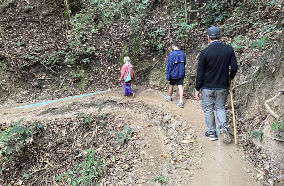
We followed the local guide.
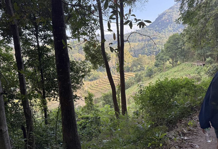
As we continued along the trail, the landscape began to open up again, and we found yourself on a slightly elevated, hilly walkway, an indication that you were getting close to the village of Ban Mae Klang Luang.
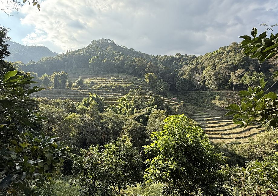
From this vantage point, the view stretched out below you, and we could see terraced rice fields carved into the hillside, their layered patterns following the natural contours of the land. Beyond the fields, the mountains rose in the distance, wrapped in forest, creating a sense of depth and quiet isolation.
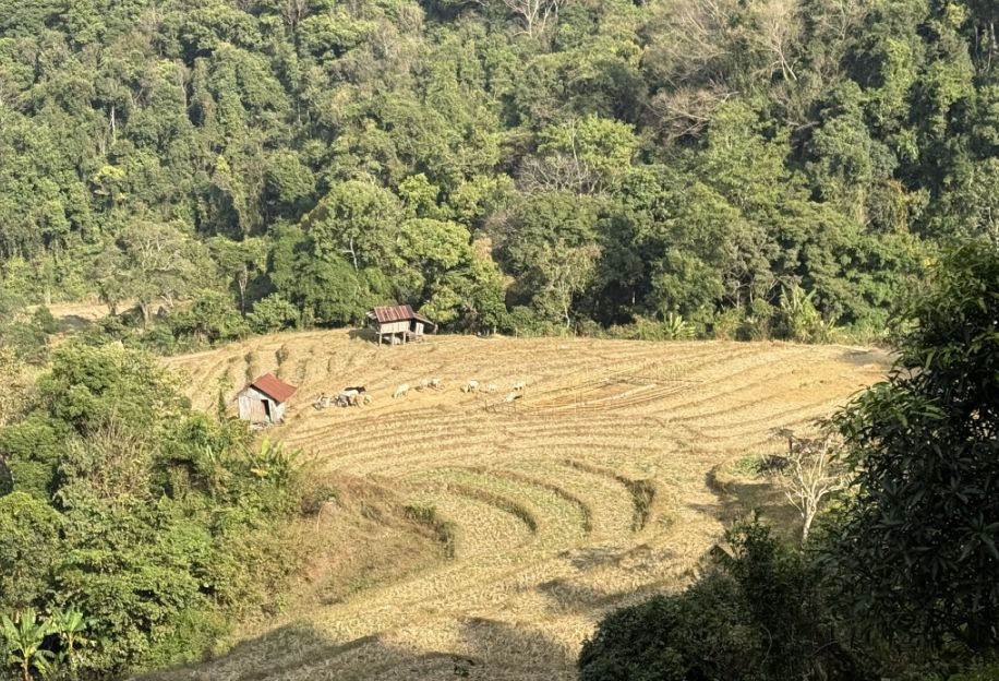
Below we can see signs of daily life with cows roaming freely, small enclosures, and a few simple wooden shacks topped with red metal roofs, scattered across the landscape.

Some sections had already been harvested, leaving behind a golden hue that gave the fields a warm, almost glowing appearance under the light.
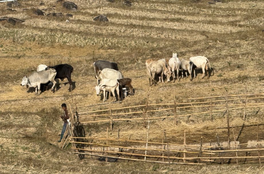
A farmer and his cows.
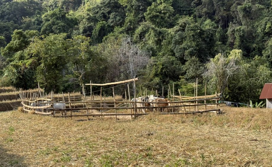
Cow enclosure.
Continuing our walk with the local guide.
We are all too slow for her, so she stopped many times to wait for us.
Crossing a simple bridge made with bamboo.
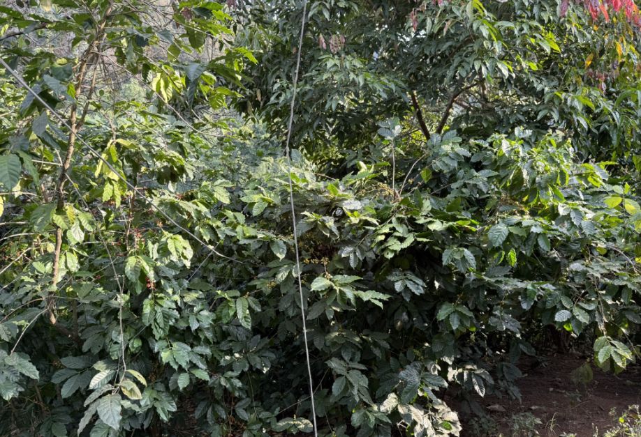
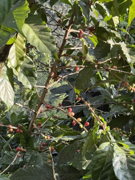
Along the way we noticed coffee trees dotted with red and yellow cherries, which is another important part of life here. Through efforts like the Royal Project Foundation, coffee became one of the key alternatives to opium farming. Today, villages like this produce high-quality Arabica coffee, and it has become an important and sustainable source of income.
 |
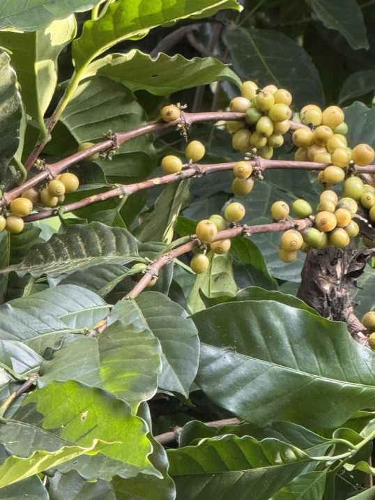 |
Coffee grows particularly well in this region because of the higher elevation providing cooler temperatures, the soil in these forested areas is rich and well-drained, and the mountain climate (mist, shade, and rainfall) is ideal.
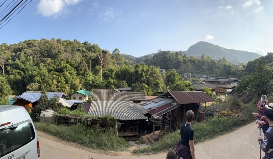
As we stepped out onto the dirt road at the end of the trail, we had clearly arrived at Ban Mae Klang Luang. From where you stood, the land dropped gently below you, revealing a cluster of homes nestled into the hillside.
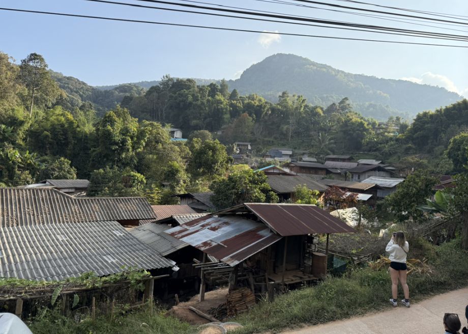
Most of the houses were built on stilts, a traditional design well-suited to this environment. It helps with ventilation in the warm, humid climate, protection from rain runoff during the wet season.
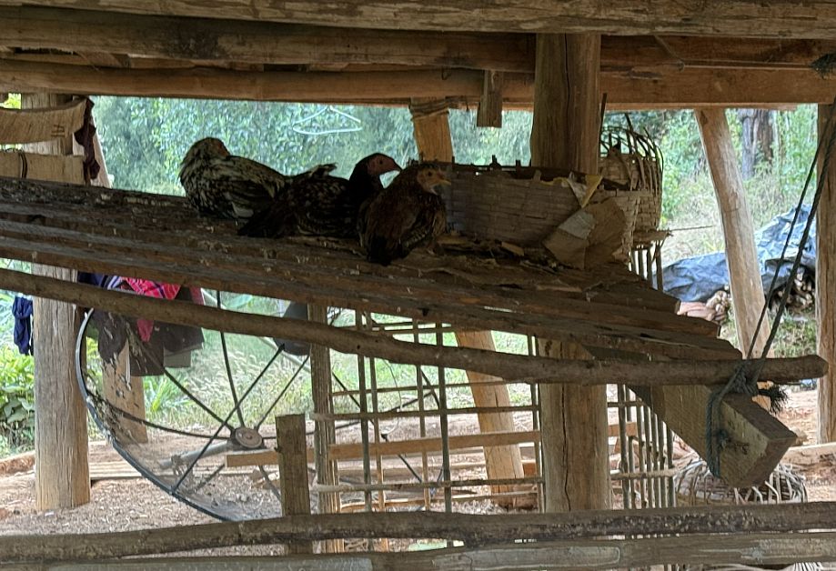
Underneath the house, the space is use for storage or for animals' shelter.
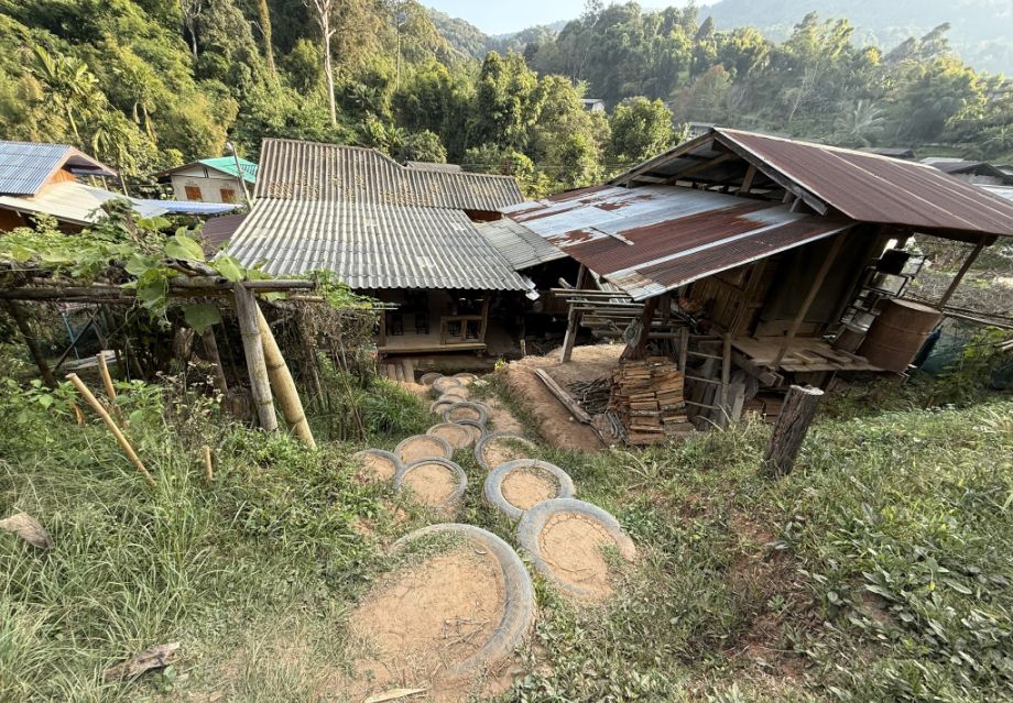
The metal roofs are more modern additions, practical, durable, and easier to maintain than traditional thatch, especially with changing weather patterns. What makes this village special is that it’s home to the Karen hill tribe, a community that has lived in these mountains for generations. Today, their way of life blends tradition with adaptation. Notice how they used old tires filled with dirt to a makeshift steps as a safer way to move up and down in rainy conditions. It’s simple, resourceful, and effective, nothing goes to waste
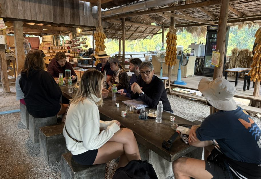
Ending the hike in a small coffee shop felt like a natural transition from trail to community. Everyone gathering together, sitting down after the walk, created a relaxed and shared moment. The coffee we tasted came from the very hills you just walked through. Grown at high altitude, these are typically Arabica beans, known for smooth, mild acidity, with subtle fruity or floral notes. Some people may have chosen tea, but either way, it’s less about the drink itself and more about the setting, resting in the village, surrounded by the landscape that produced it.
Our day unfolded as a beautiful journey through different layers of northern Thailand, starting with a meaningful visit to the Living Green Foundation, where we connected up close with elephants and learned about their transition away from riding camps, then continuing into the cool, misty heights of Doi Inthanon National Park to explore the serene royal pagodas surrounded by vibrant gardens and sweeping mountain views, and finally ending with the immersive hike along the Pha Dok Siao Nature Trail, where forest paths, cascading waterfalls, cultural touches, and terraced farms gradually led us into the peaceful rhythm of village life in Ban Mae Klang Luang. A full day that moved seamlessly from wildlife to spirituality to nature and community, leaving us with a deep appreciation for both the landscape and the people who call it home.
NEXT... Day 6- Wat Chedi Luang