12 days in Thailand 1/7- 1/18/2025
Day 11-Island hopping -1/17/2025
3rd Stop: Ao Phang Nga National Park
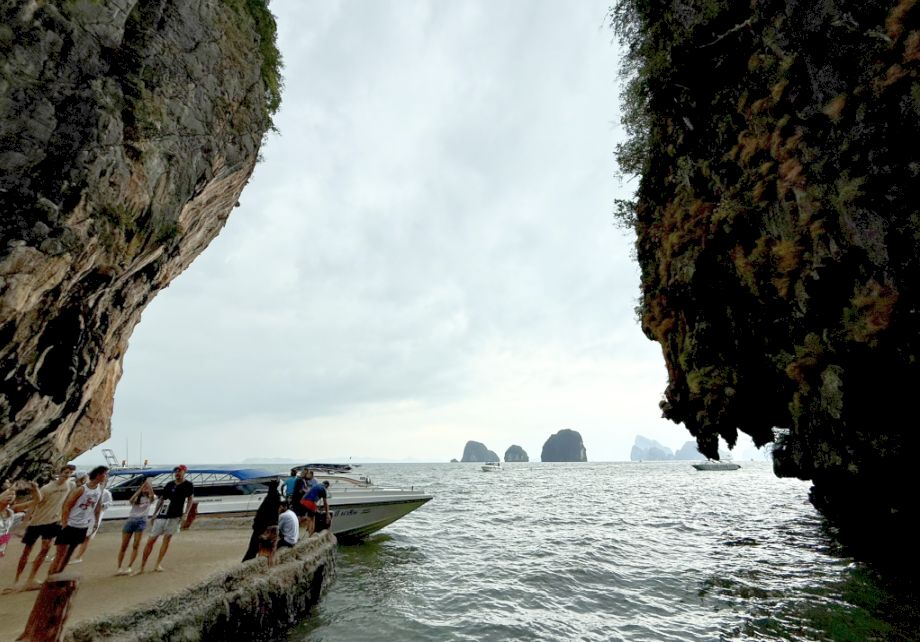
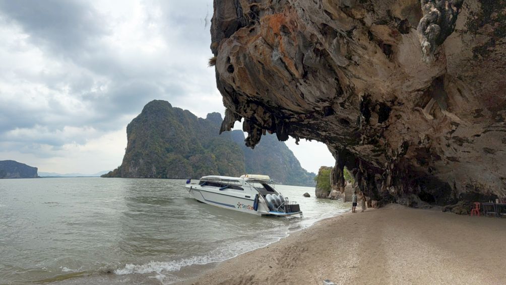
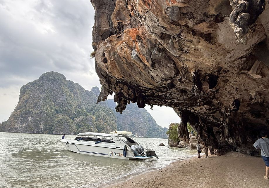
Our boat brought us right into one of Thailand’s most iconic natural landscapes, Ao Phang Nga National Park, and everything around you reflects millions of years of geological history.
Established in 1981, this marine national park was created to protect the dramatic limestone karst scenery that rises sharply out of the emerald-green waters of Phang Nga Bay. The area covers over 400 square kilometers and includes mangrove forests, caves, lagoons, and dozens of small islands. Beyond its beauty, the park plays an important ecological role: the mangroves serve as nurseries for fish and crustaceans, while the cliffs and caves provide habitats for birds, bats, and other wildlife. Today, it’s both a conservation area and one of southern Thailand’s most visited natural attractions.
As we walked along this elevated platform and into the park, surrounded by towering cliffs, we were essentially stepping into a landscape shaped over 250–300 million years ago. The limestone that forms these karst mountains began as coral reefs and marine sediments on an ancient seabed. Over time, tectonic movement lifted these limestone rocks above sea level, and rainwater, slightly acidic, slowly dissolved the rock, carving out caves, hollow chambers, and the steep, vertical cliffs we see today.
 |
 |
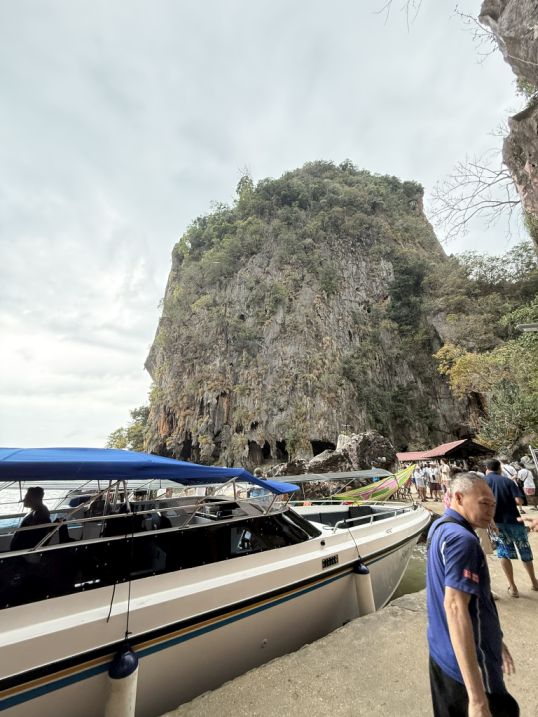
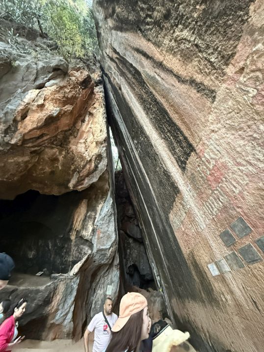
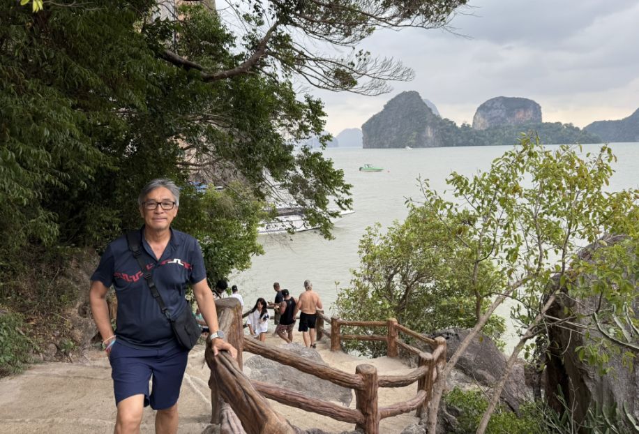
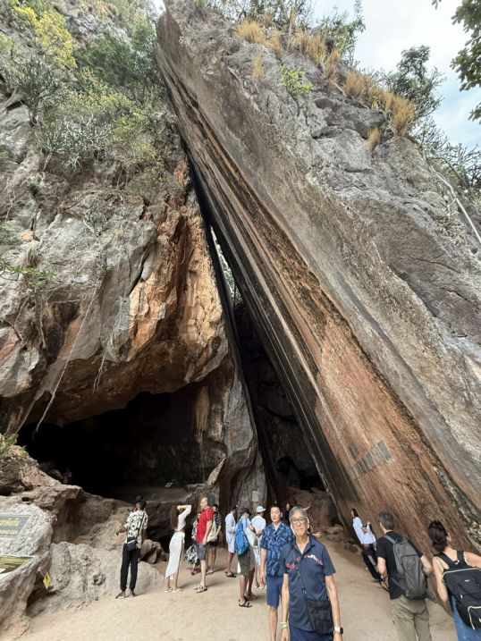
Following the path to Khao PHin Kan, the tall vertical rock.
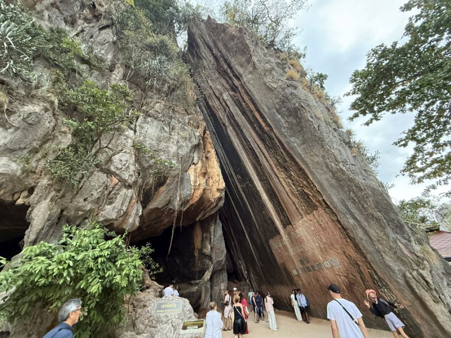
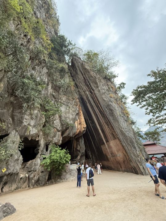
Khao Phing-Kan means “hills leaning against each other,” and when you see it up close, it looks like two massive slabs of rock split apart but still resting side by side.
 |
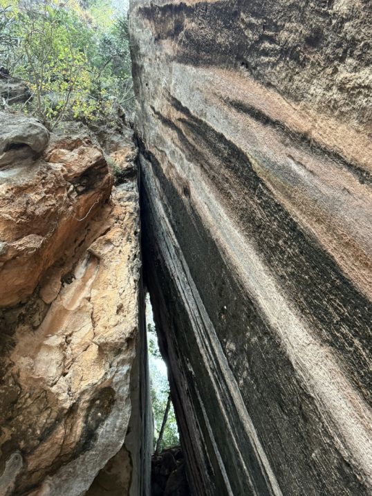 |
This split likely occurred along natural fractures in the limestone, widened over time by erosion and water seepage. The result is that dramatic cleft, giving the impression that the mountain has been cleanly sliced in two.
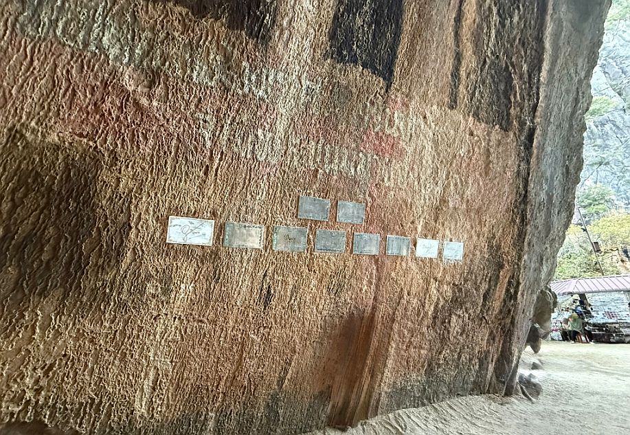
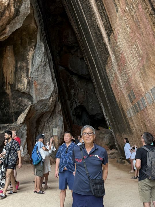
These silver metal plaques inside the vertical rock at Khao Phing Kan are probably official Visit Plaques. Thailand sometimes marks significant visits by government officials, royal projects, or park designations with plaques. Or Since Ao Phang Nga National Park is a protected area, these plaques could also be part of conservation work used to label or monitor specific sections of the rock face.
 |
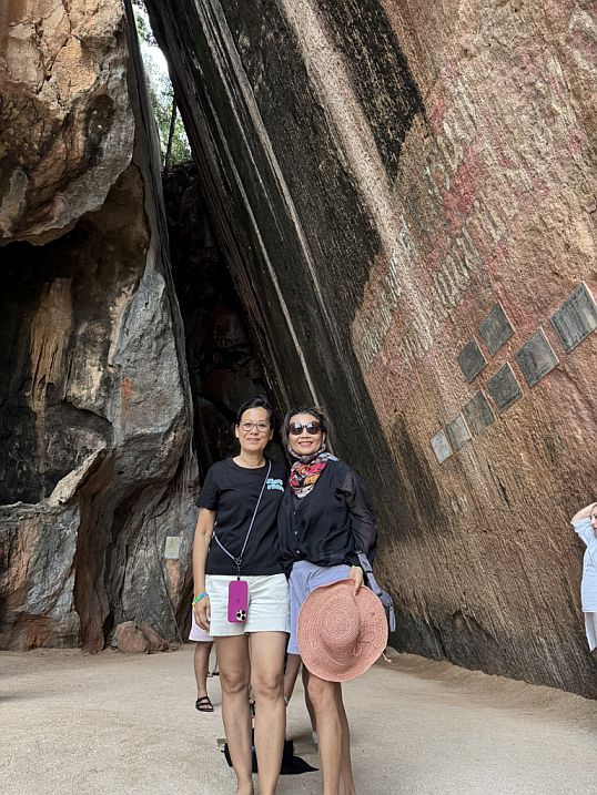 |
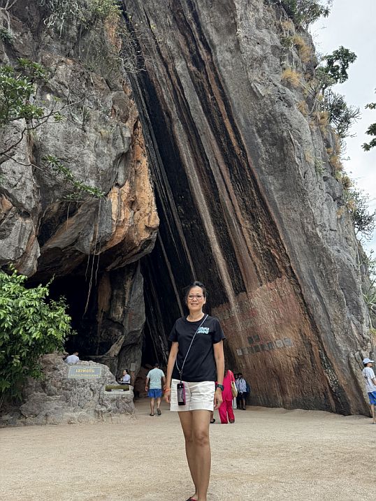
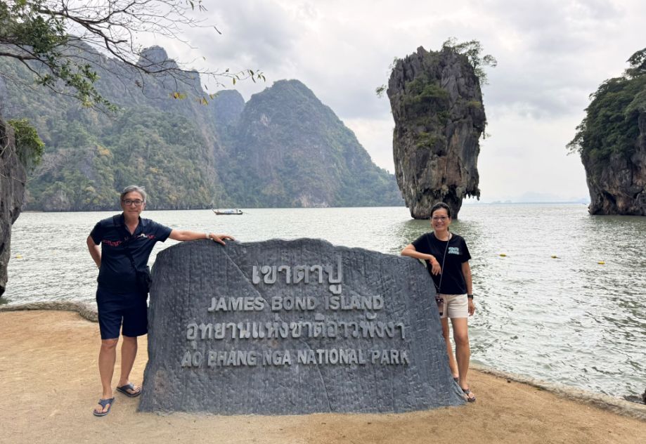
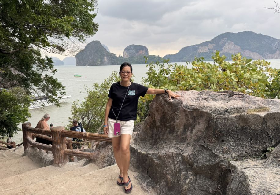
Me and Loan in front of Khao Phing Kan.
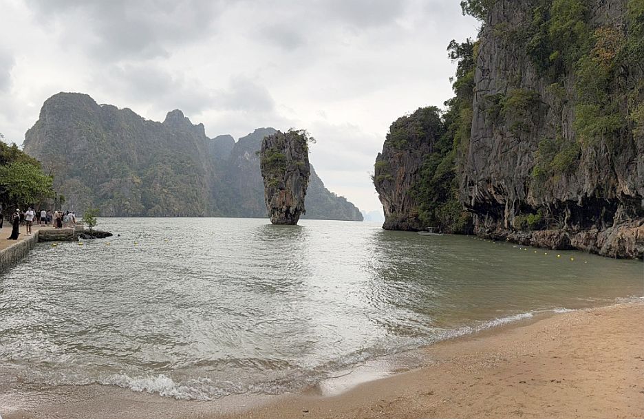
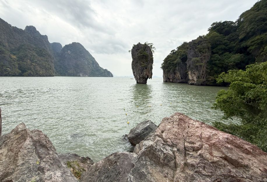
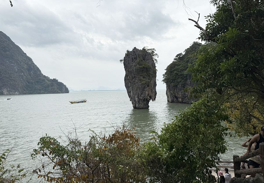
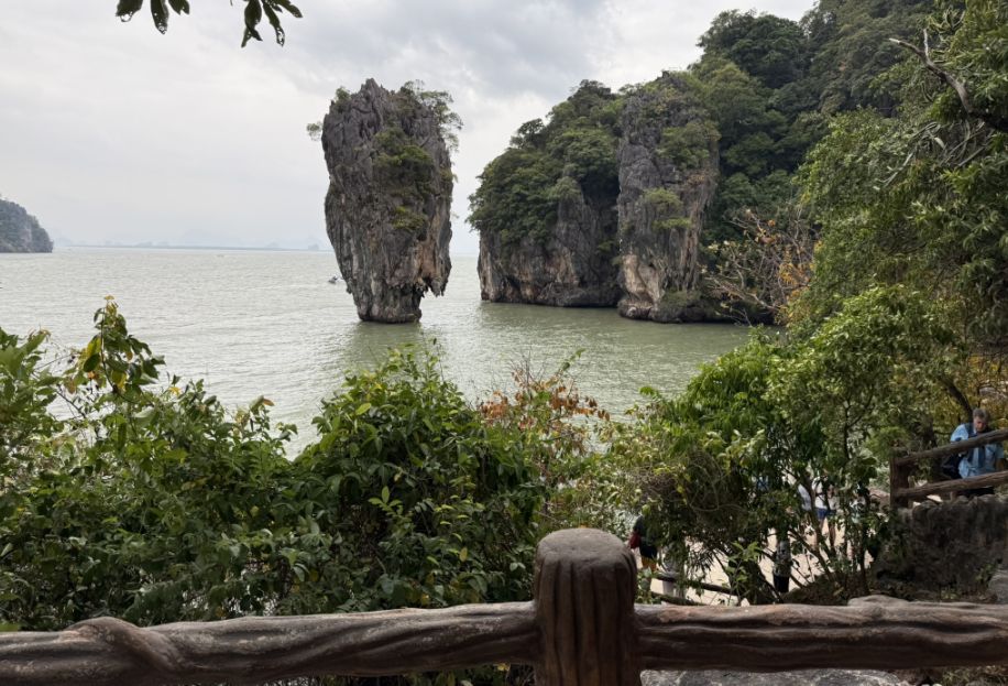
Just offshore stands the most famous feature of all, James Bond Island, also known locally as Ko Tapu. This narrow limestone pillar rises about65 feet out of the water, with a striking shape: wide at the top and dramatically tapered at the base, almost like it’s balancing on a point.
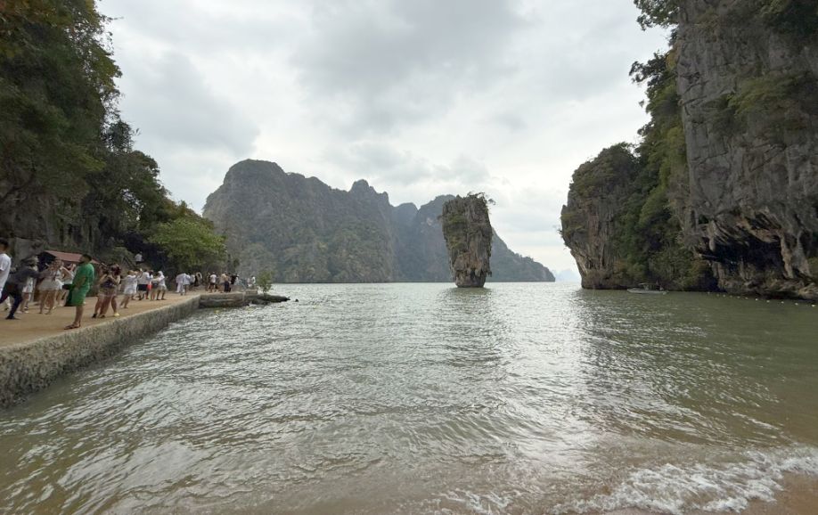
Standing there, with sheer cliffs enclosing the bay and that iconic rock rising out of still water, it’s easy to feel how secluded and almost otherworldly this place is, a landscape shaped slowly by nature, but now shared with the world.
Its formation is a classic case of differential erosion. The lower part of the rock has been worn away more quickly by constant wave action, tidal currents, and chemical weathering, while the upper portion remains relatively intact. Over time, this created that “inverted nail” or “mushroom” shape that makes it so visually unique.
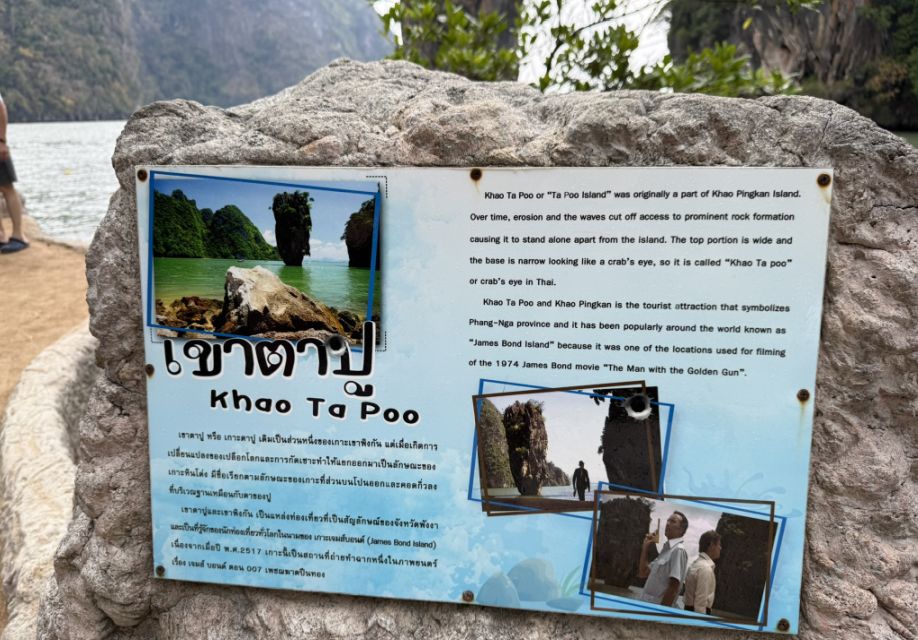
The island gained worldwide fame after appearing in the 1974 James Bond film The Man with the Golden Gun, starring Roger Moore.
Since then, it has become one of Thailand’s most photographed landmarks, drawing visitors from around the world.
As we moved away from the main sandy stretch and toward the back of Khao Phing Kan, the perspective begins to shift in a really striking way. The postcard view of James Bond Island gives way to something quieter and more textured, rocks scattered along the shoreline.
Then , clusters of trees and low bushes softening the edges, and the towering limestone walls framing everything in a more intimate way.
The stairs we climbed act almost like a natural balcony. From there, the scene opens up: layers of karst mountains rising in the distance, their silhouettes fading into soft blue-gray as they recede across the bay.
Below, the water sits calm and glassy, reflecting fragments of sky and stone. Standing there, there’s a stillness to it, the kind where you can really take in the scale of the landscape. It’s no longer just about one famous rock, but the entire bay unfolding around you, shaped by time and water.
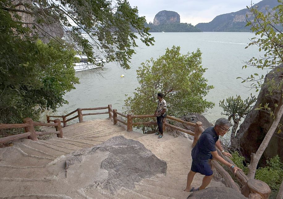
We are now going to the back side.
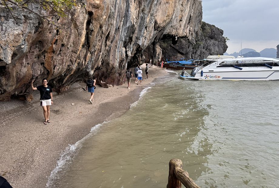
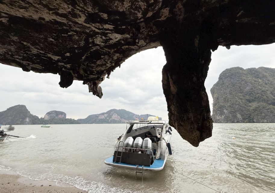
As we continued to the back side, the atmosphere changed again. The beach narrows, becoming more secluded, almost hidden.
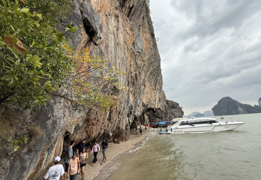
Above the sandy beach, the limestone cliffs lean outward, forming a natural overhang that feels protective, almost cave-like.
 |
 |
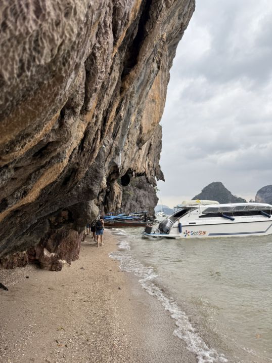
I love this area! I feels very secluded.
This is where the geology becomes more intricate and close-up, jagged textures, weathered surfaces, and clusters of stalactites hanging from the rock ceiling, formed slowly over thousands of years as mineral-rich water dripped and solidified.
The formations feel alive in a way, each one slightly different, shaped drop by drop.
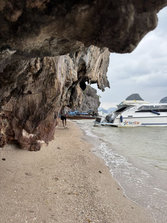
Walking along this stretch, the light shifts too, filtered and softened by the overhanging rock, creating shadows and cool pockets of air. It’s a contrast to the bright openness of the front beach.
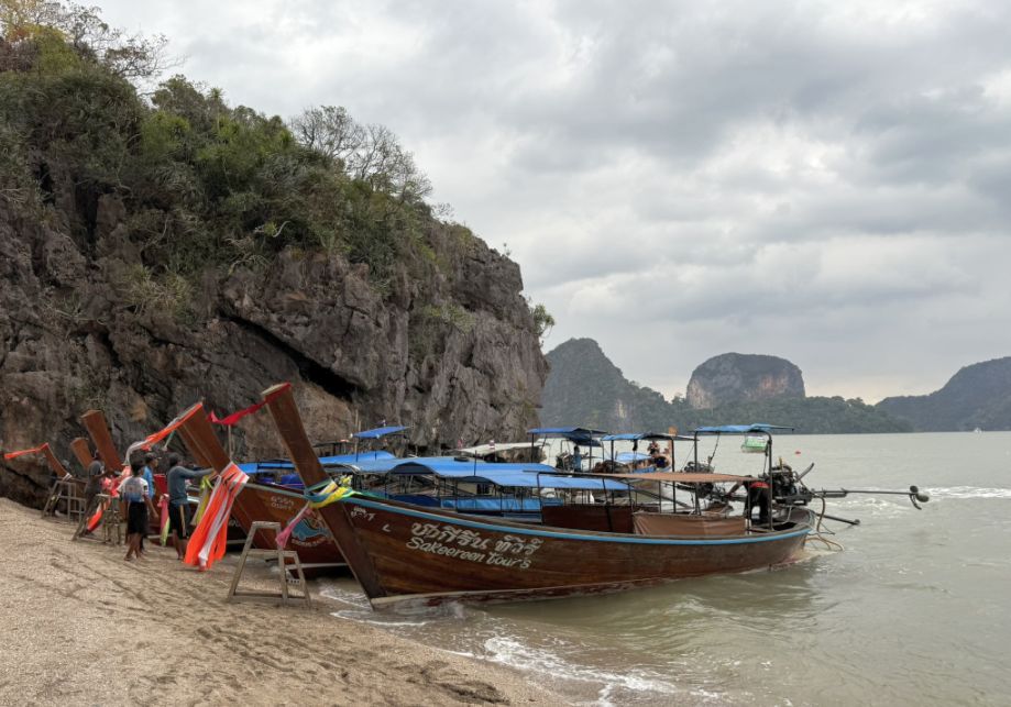
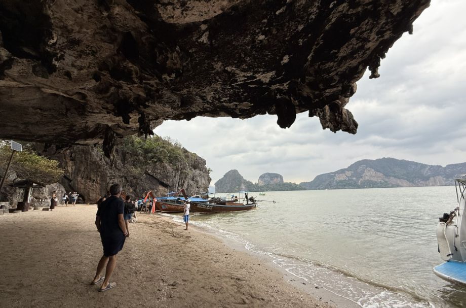
At the far end, the scene opens just enough to reveal those wooden longtail boats, painted in bright, cheerful colors.
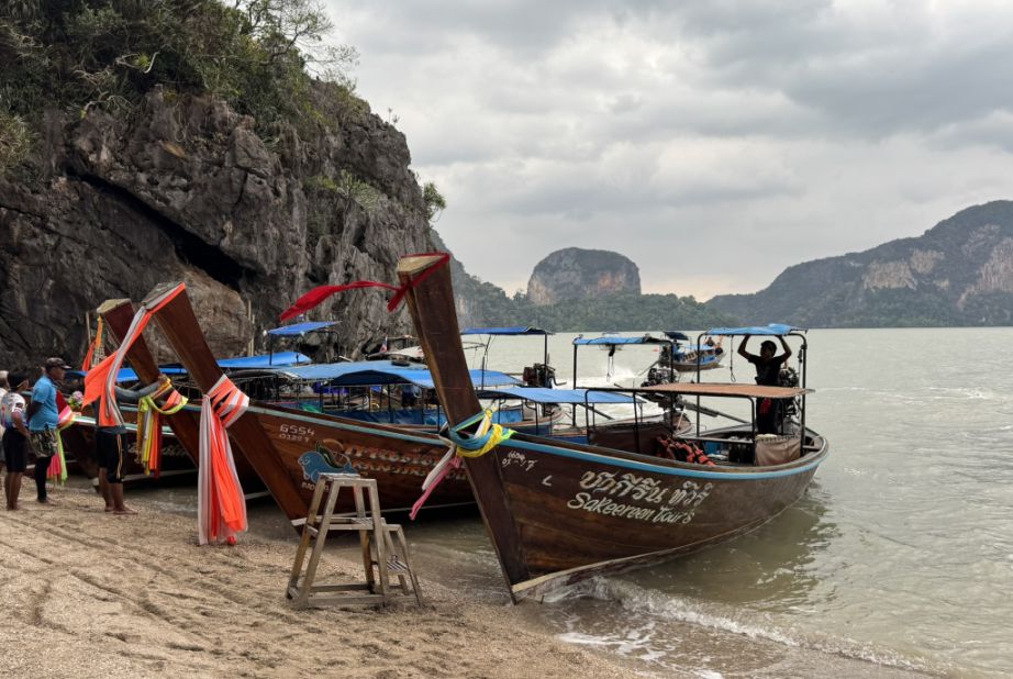
They sit gently in the shallow water, adding a human touch to an otherwise ancient landscape.
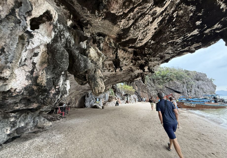
This side of the beach feels more local and less hurried, where the dramatic geology, the quiet shoreline, and the everyday rhythm of boats coming and going all come together.
We are now leaving the beach and going back to the main park.
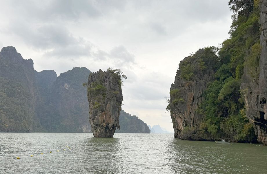
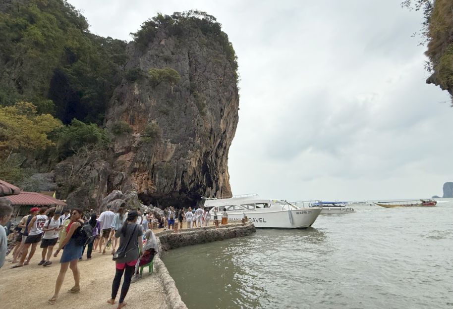
As we made our way back, passing James Bond Island once more, the scene seemed to come together in one last perfect composition. The elevated platform ahead framed everything beautifully, the stairway lined with greenery at its base, softening the concrete, while the iconic limestone pillar stood almost perfectly centered in the water. Off to the left, massive karst mountain rose dramatically, its sheer face adding weight and balance to the view. It’s one of those moments where nature and viewpoint align just right, almost like a carefully staged photograph, but entirely real.
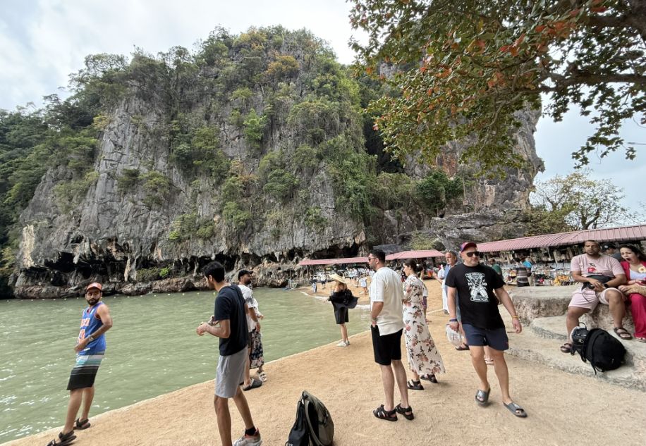
Back at the main area of Khao Phing Kan, the atmosphere shifted again. The quiet, secluded feeling of the back beach gave way to a more lively, commercial energy. Small shops lined the waterfront, selling souvenirs, drinks, and snacks, colorful and bustling, with visitors moving in and out.
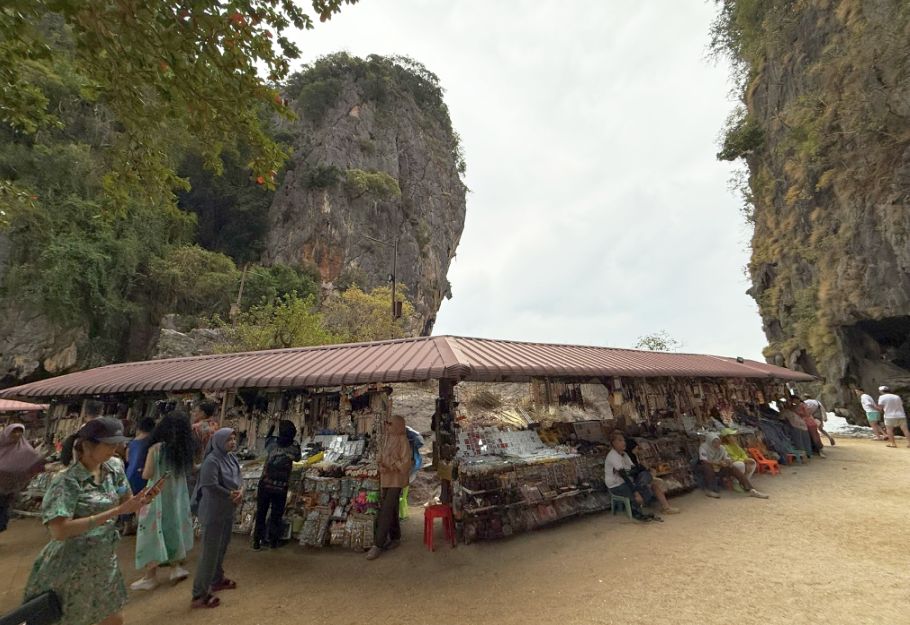
It’s a reminder of just how popular this place has become, drawing people from all over the world to experience what we just saw.
 |
 |
We walked past another towering vertical rock formation near the shoreline, it almost felt like a final send-off from the landscape, one last reminder of the raw, sculpted beauty of Ao Phang Nga National Park.
Then, stepping back onto our boat, the scene slowly began to drift away. The cliffs, the platform, and that iconic rock gradually shrinking into the distance as we headed onward, this time toward the floating Muslim village of Ko Panyi, where a completely different side of life in the bay awaits, built not on land, but above the water itself.
NEXT... Day 11- Ko Panyi, Muslim floating village