Three weeks in New Zealand - 4/12 - 5/4/2024
Day 18-The trek back-4/28/2024
After reaching Hooker Lake (the last leg of the trail), we are now walking back to the parking lot.
|
|
|
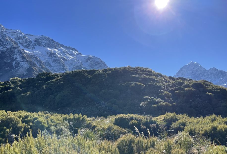
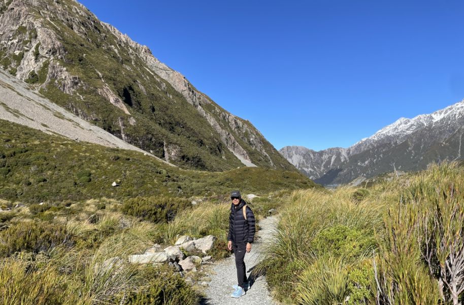
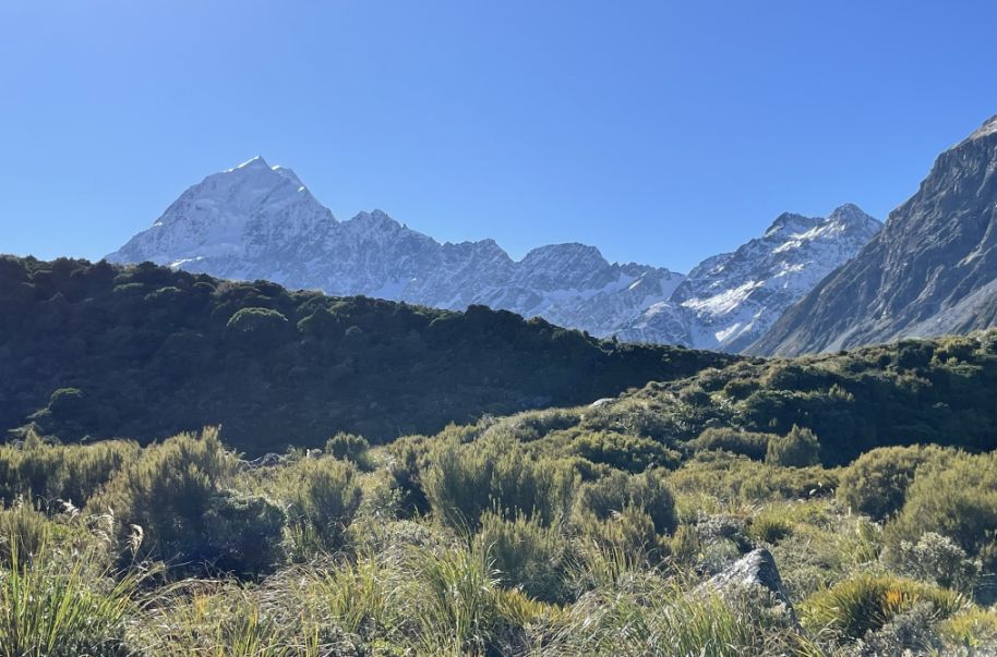
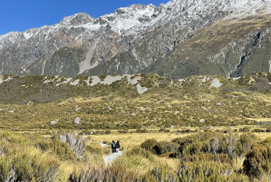
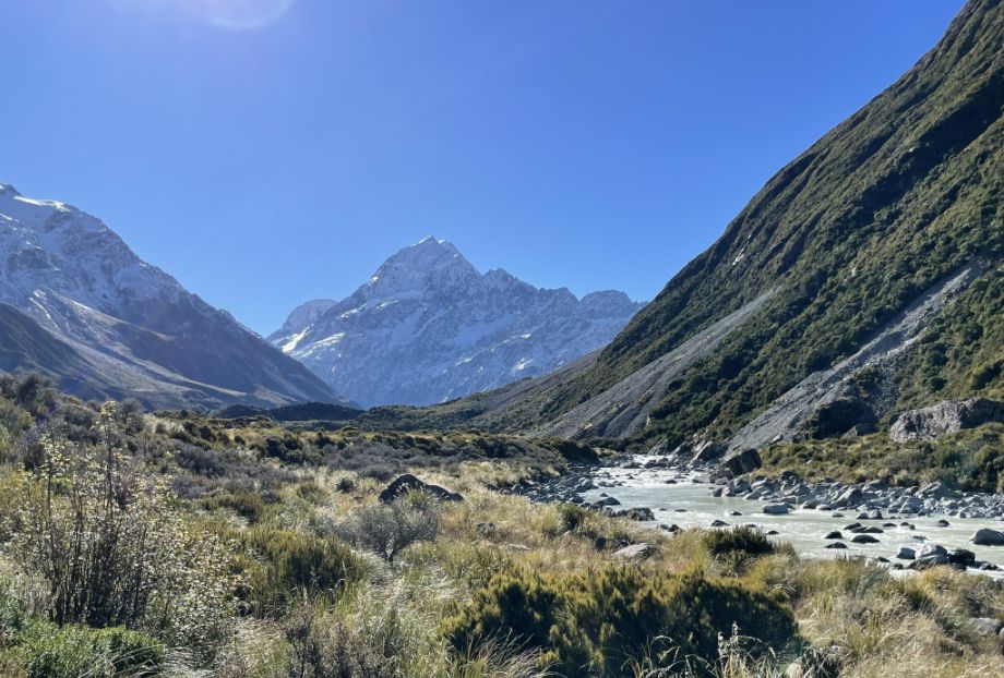
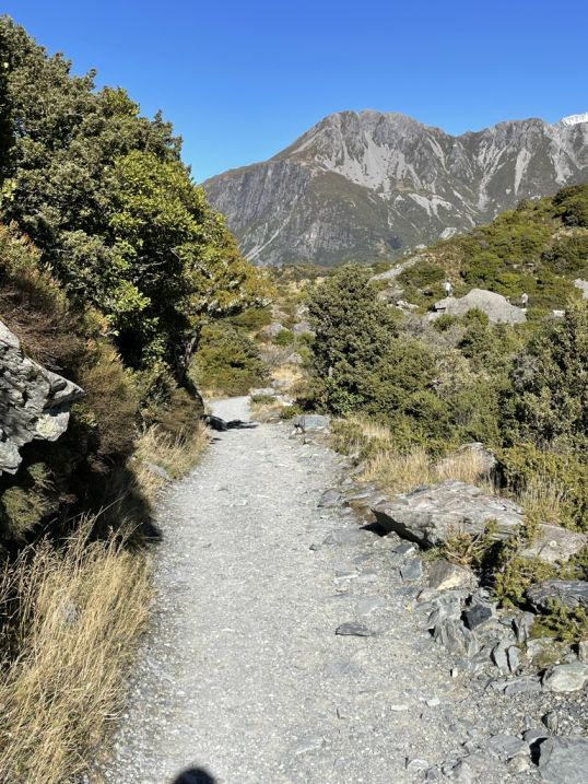
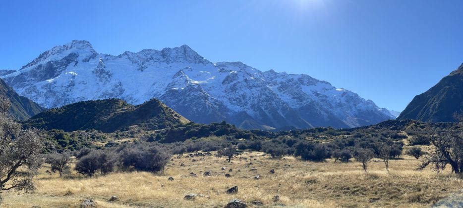
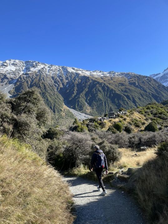
As we are head back along the gravel trail, the path gently weaves through a wide alpine valley, flanked by rugged terrain and scattered with hardy, low-lying bushes that have taken on golden and rust-colored tones in the autumn light.
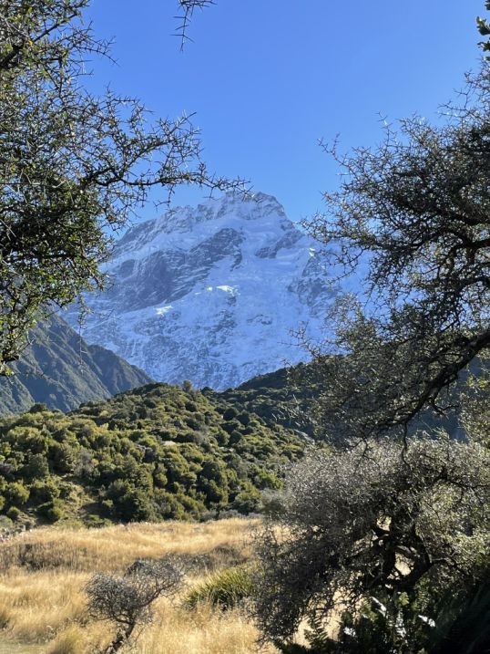
In front of us is the Aoraki Mount Cook, which stands proudly and majestically.
With the sun shining brightly overhead around noon, the landscape is vivid with crisp blue skies, and icy snow cap of the summit of the Aoraki/Mount Cook.
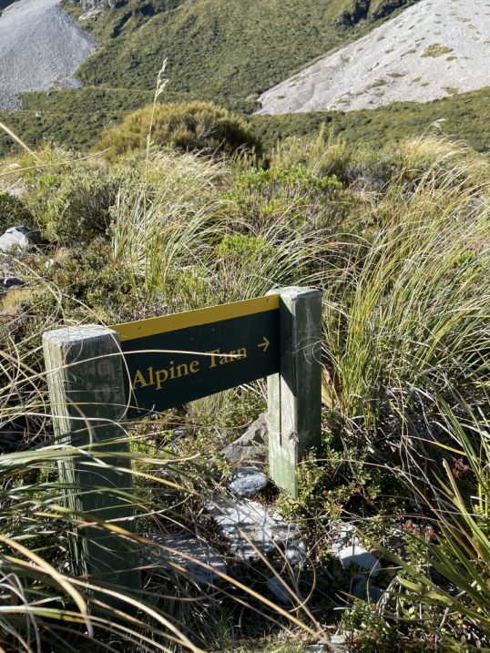
As we are near the Alpine Tarn on the return from Hooker Lake, the landscape takes on a quiet, and reflective beauty.
 |
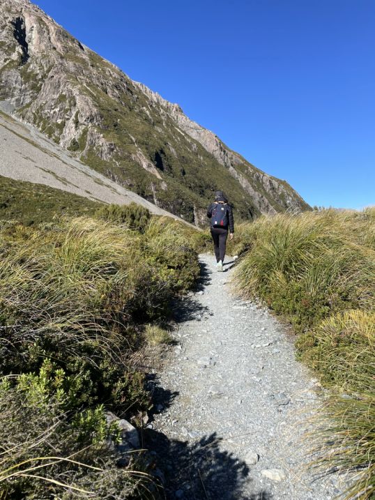 |
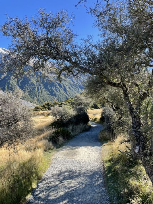
Following the trail.
The trail goes through low alpine shrubs and hardy tussock grasses which dominate the terrain. The gravel path winds gently around the tarn.
The light at this time of day casts a glow over the landscape and the open space feel both serene and wild.
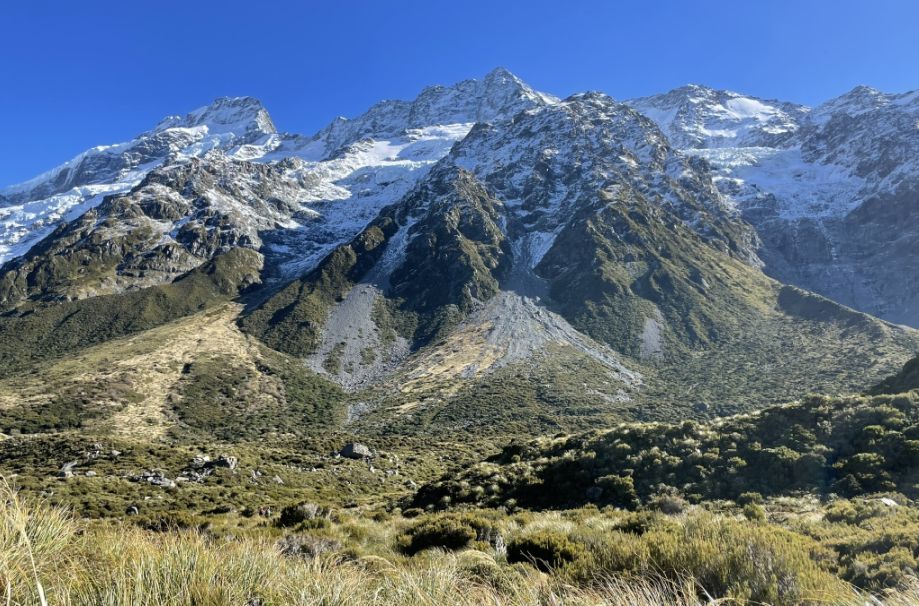
The ever-present form of Aoraki/Mount Cook with jagged ridgelines frame the scene.
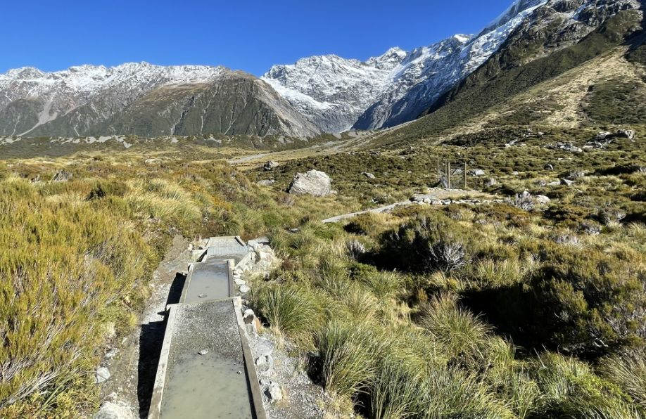
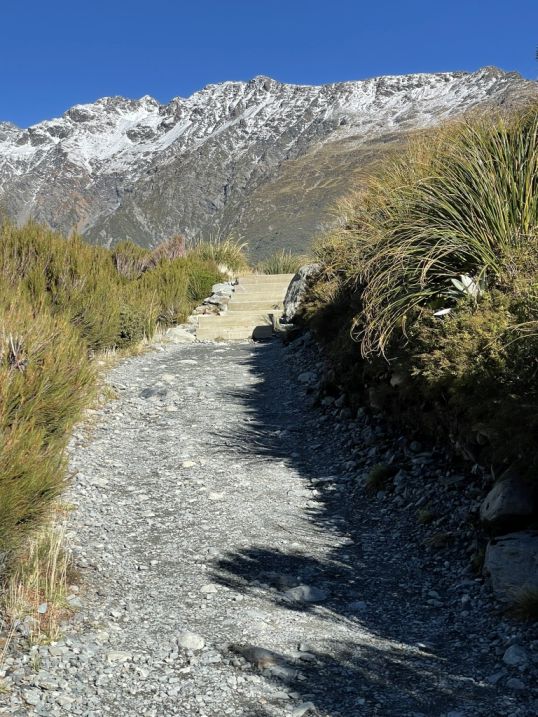
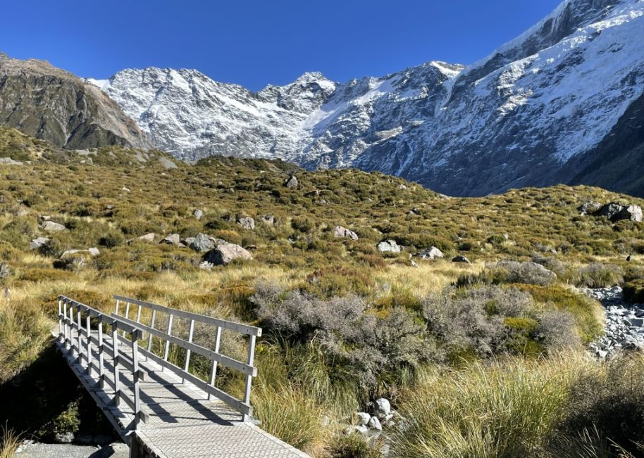
As we approached the third bridge on the return from Hooker Lake, the trail transitions onto a raised cement walkway, a subtle but striking contrast against the natural alpine surroundings. Elevated slightly above the rocky ground and alpine grasses, the walkway offers a smooth, even path, guiding hikers safely over areas that may be seasonally wet or uneven.
 |
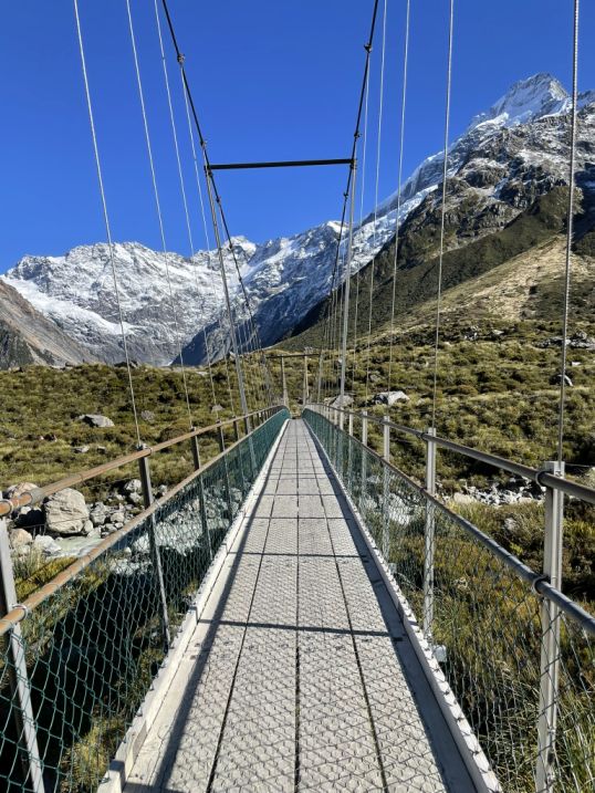 |
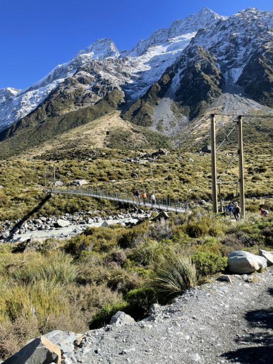
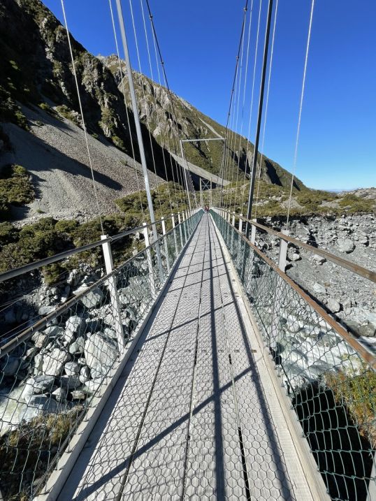
With the sun high overhead, the scene is bright and sharp when we reached the 3rd suspended bridge.
 |
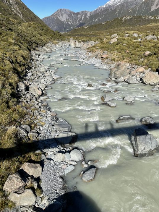 |
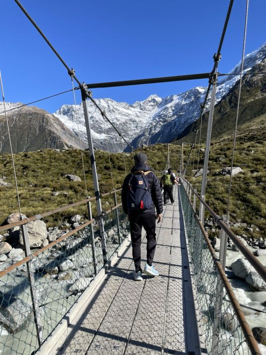
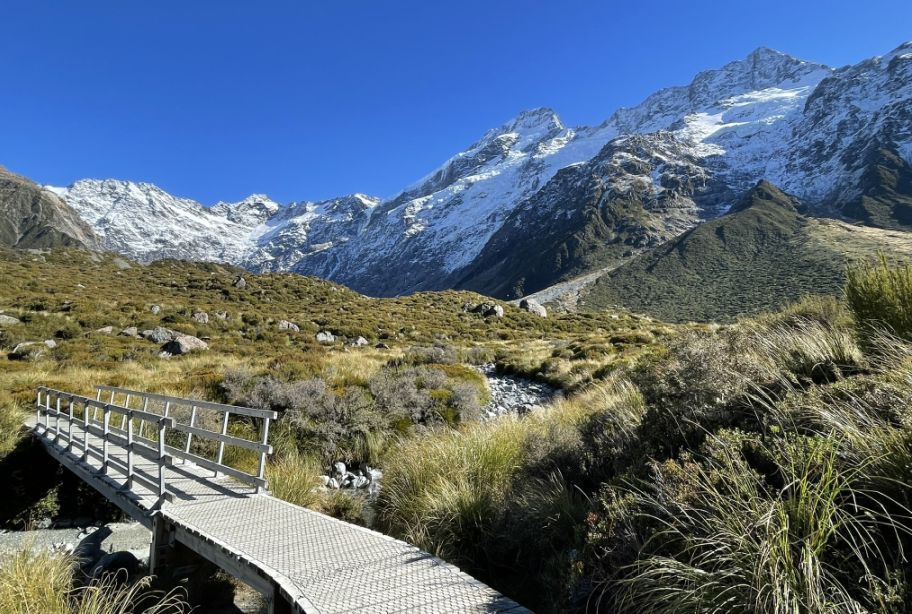
Standing on the third suspension bridge, we are suspended above a rocky glacial stream that rushes below, its waters fed by the melting snowfields high in the mountains.
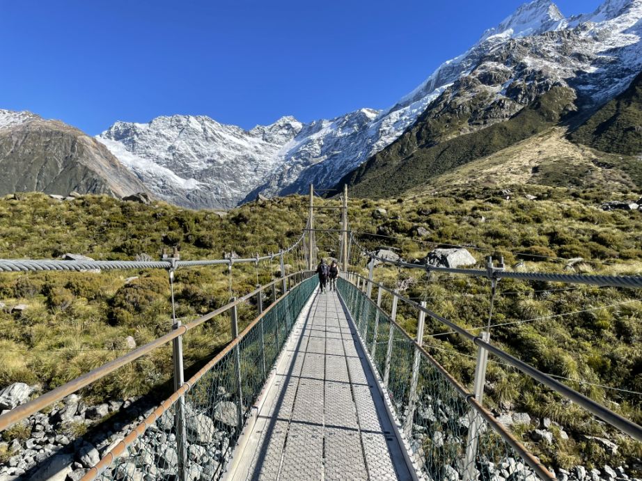
As we looked back up, a breathtaking view opens before us, with the snow-capped summit of Aoraki/Mount Cook rising majestically against the clear blue sky.
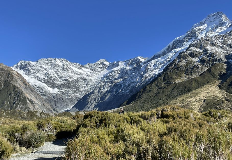
After crossing the third suspension bridge, the trail opens up into a vast, sweeping alpine plain, an expansive field bathed in golden hues from the autumn vegetation. The low shrubs and tussock grasses glow in shades of amber, bronze, and gold, stretching out in all directions under the wide blue sky.
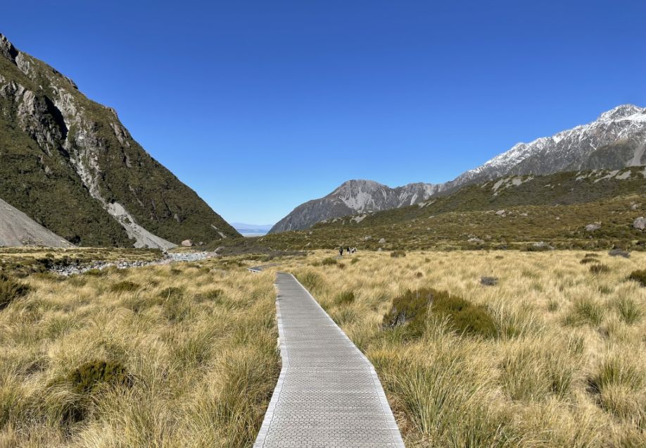
Cutting through this stunning landscape is the iconic wooden boardwalk, gently curving and rising above the uneven ground. Its weathered planks guide us forward, adding a rhythmic contrast to the wild terrain.
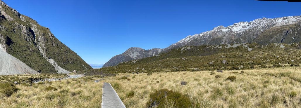
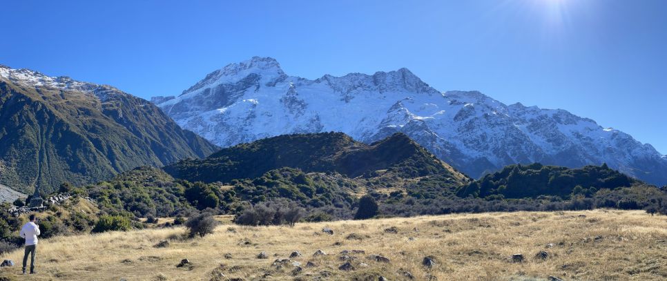
Panoramic view of the openness of the field, the golden light, and the space create a serene and unforgettable moment. To the right is Mount Wakefield, to the left is Mount Sefton.
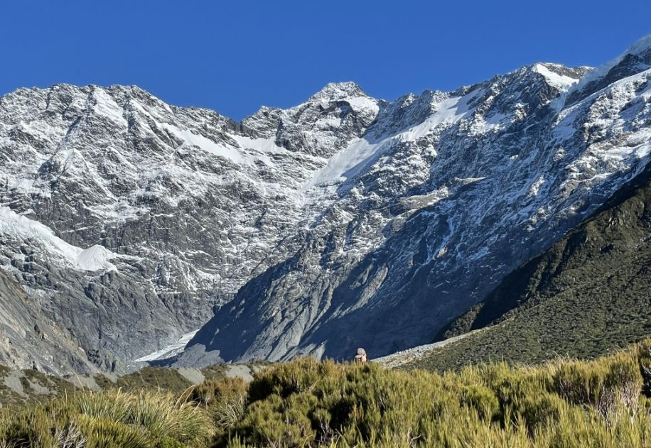
Mount Wakefield, this long, ridged mountain stretches along the eastern side of the Hooker Valley. As you walk north, it forms the wall to your right. Though not as tall as Mount Sefton, it’s equally striking in form and catches beautiful light in the late morning and early afternoon.
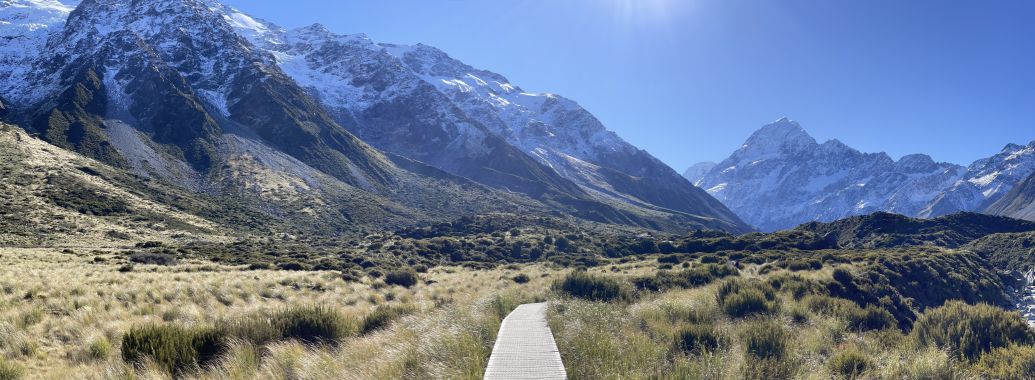
The left is Mount Sefton, a dramatic, glacier-draped peak towering above the western side of the Hooker Valley. It often has cascading icefalls and is part of the Main Divide. It’s one of the most imposing peaks you'll see on this side as you walk back.
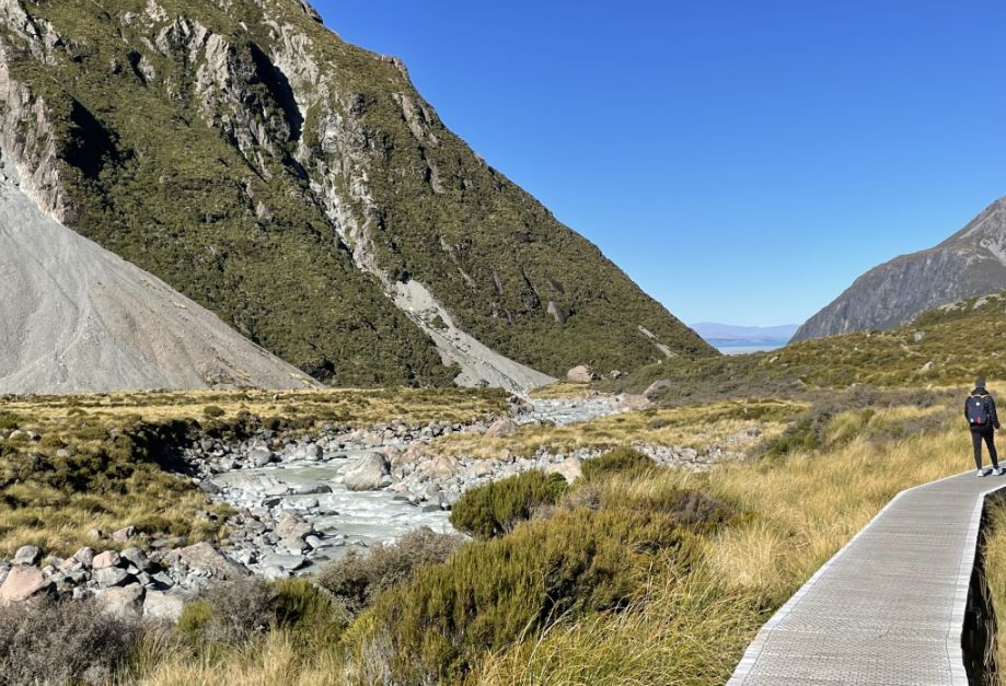
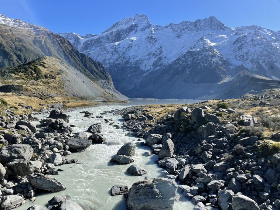
Beside the wooden boardwalk, the Hooker River flows steadily beside the trail, tracing a silvery path through the valley floor.
It's a glacial river, born from the meltwater of Hooker Lake and the Hooker Glacier, which gives it that distinctive milky gray hue, caused by finely ground rock flour suspended in the water.
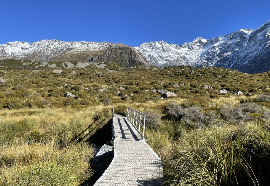
As we continue on, the trail leads you over a small wooden bridge that crosses a narrow, clear stream feeding into the Hooker River.
The bridge creaks gently underfoot, blending seamlessly into the alpine surroundings, with wooden railings weathered by wind and time.
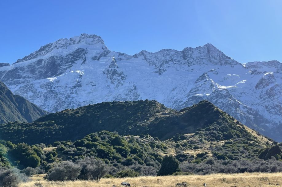
To the right, rising dramatically above the golden grasses and low shrubs, is the snow-covered face of Mount Wakefield. In this direction, the mountain dominates the skyline with its sharp ridgelines and steep, rugged slopes streaked with snow. The snow clings to its upper reaches, even in autumn, creating a striking contrast against the dark rock and the deep blue of the midday sky.
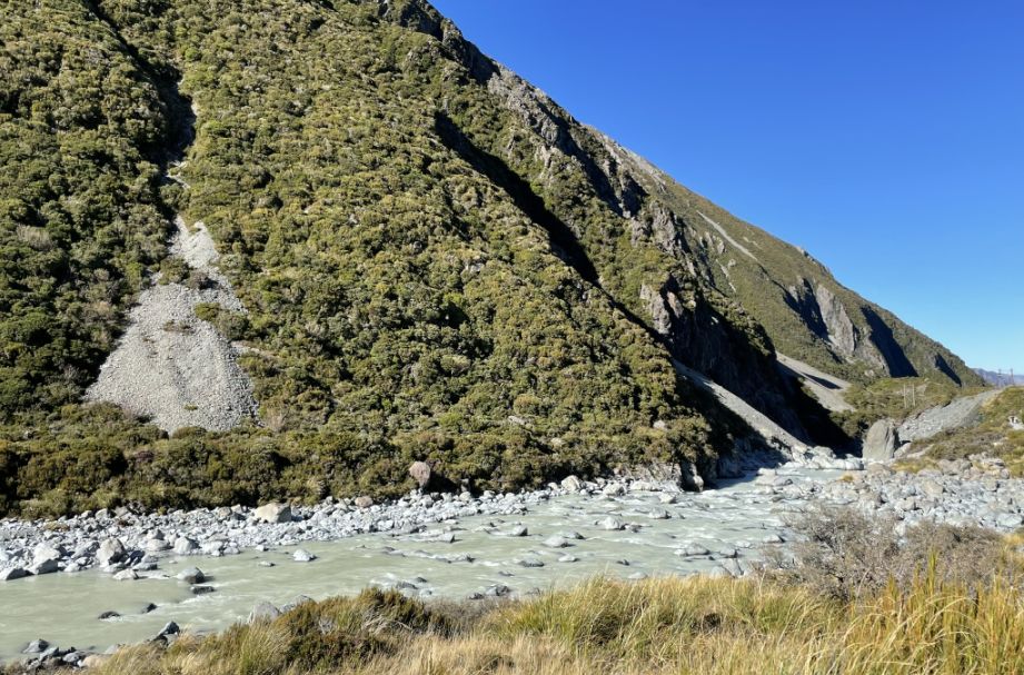
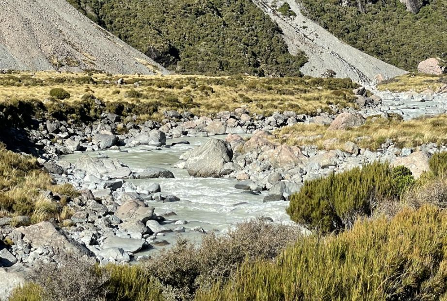
As we walked further down the trail, the Hooker River runs steadily alongside, now becoming more dramatic in character.
The water tumbles over large boulders and rock formations, swirling around them in frothy white currents.
The glacial melt gives the river its signature milky gray color, glowing softly under the midday autumn sun.
 |
 |
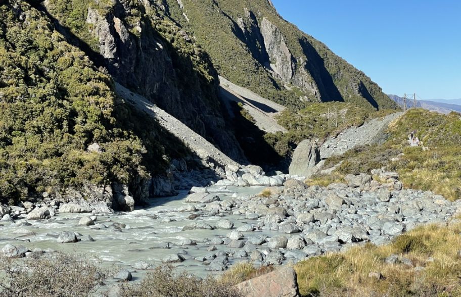
Water running through big boulders.
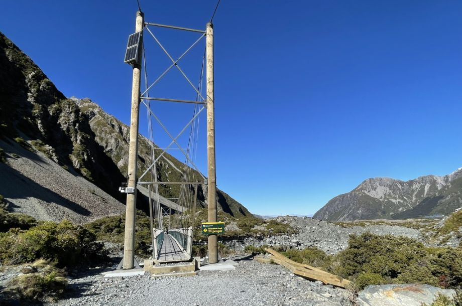
We are reaching the second suspension bridge.
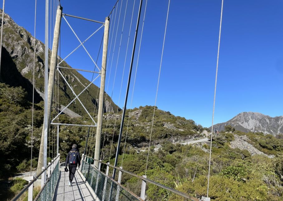
Its cables stretched between tall steel towers and its narrow wooden planks gently swaying in the breeze.
 |
 |
Crossing the bridge and then we followed the gravel trail.
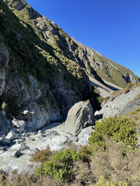
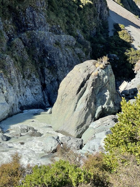
This rocky section of the river, where the water rushes noisily through a channel scattered with massive glacial boulders.
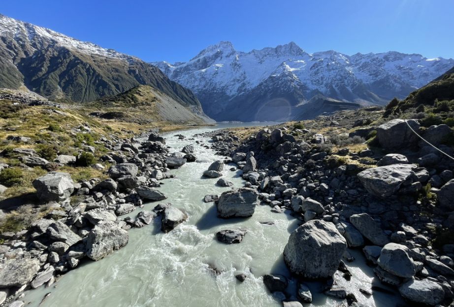
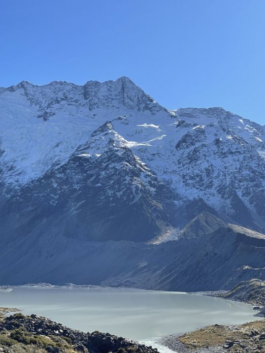
On both sides of the valley, the mountains still rise steep and commanding Mount Sefton to the west and Mount Wakefield to the east, framing the path with their snowy peaks and shadowed ridges.
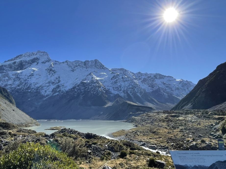
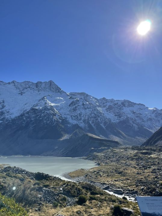
As we looked in the distance is the Mueller Lake, a stunning proglacial lake sitting just upstream of the second bridge. Formed by meltwater from the Mueller Glacier and Mount Sefton’s icefields, this lake is often filled with ice-cold, sediment-rich water, giving it a milky turquoise or gray color depending on the light.
 |
 |
The calm lake is framed by snowcapped peaks on one side, and the roar of glacial runoff powering downstream on the other.
The trail stretches ahead through a vast, open grasslands and low-growing alpine shrubs. The terrain is mostly flat here, giving a full panoramic view of the valley.
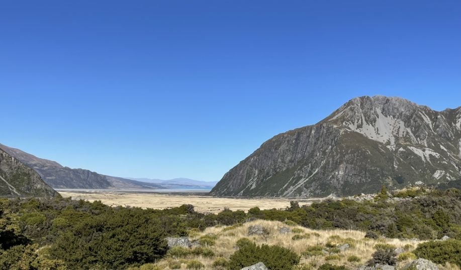
To the right (east) is the long ridge of Mount Wakefield, its rocky slopes streaked with lingering snow.
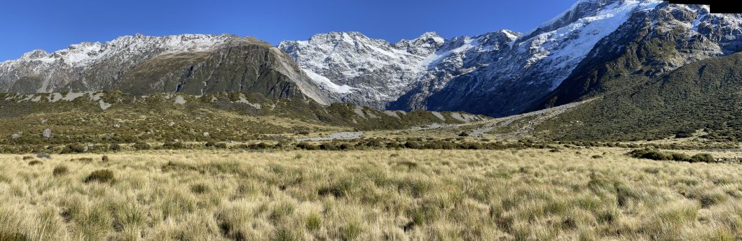
As you continue walking through the wide, open stretch of the Hooker Valley, the view becomes increasingly dramatic with snow-capped mountains with sharp ridges creating a breathtaking alpine amphitheater.
The ridgelines are jagged and bold, etched sharply against the sky.
Panoramic view of Mount Sefton, showing off its heavily glaciated slopes and dramatic rock faces.
 |
 |
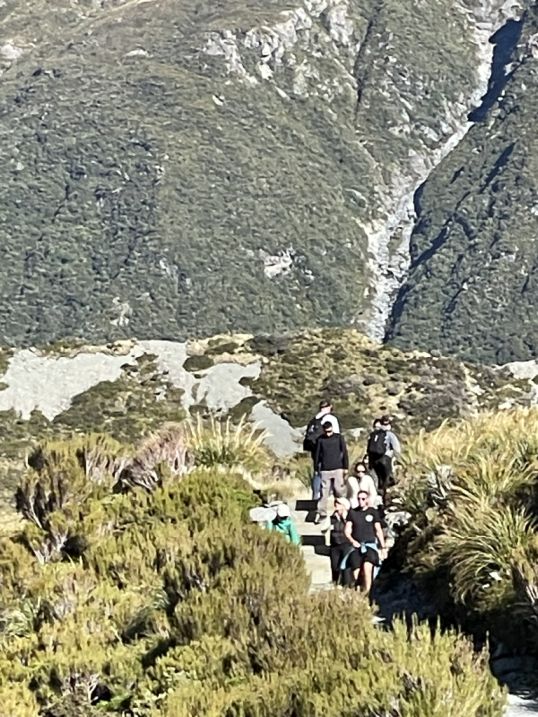
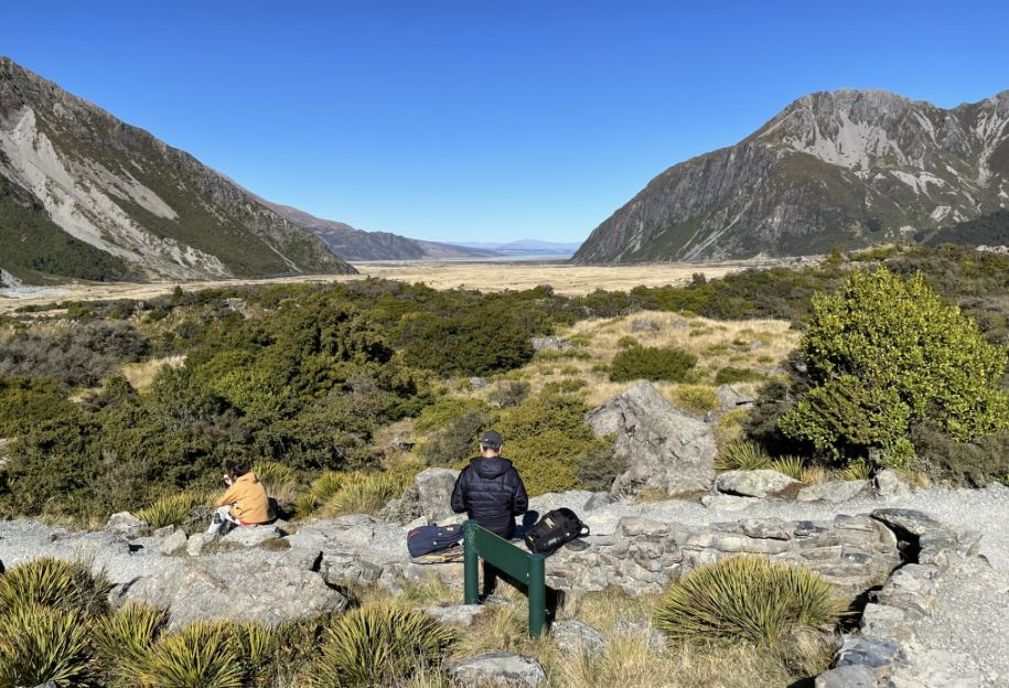
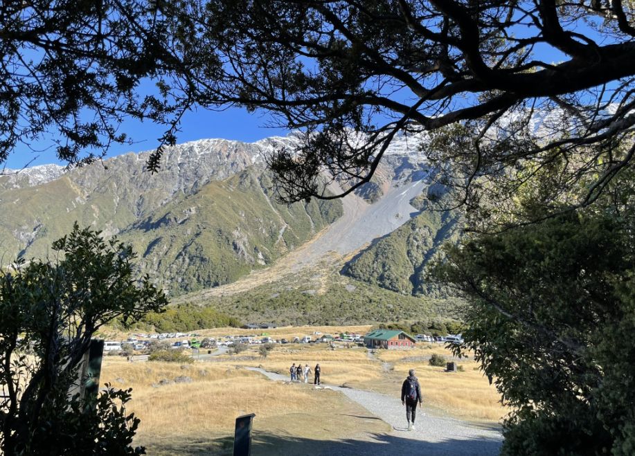
Our hike is almost over now as we are getting closer to the parking lot.
 |
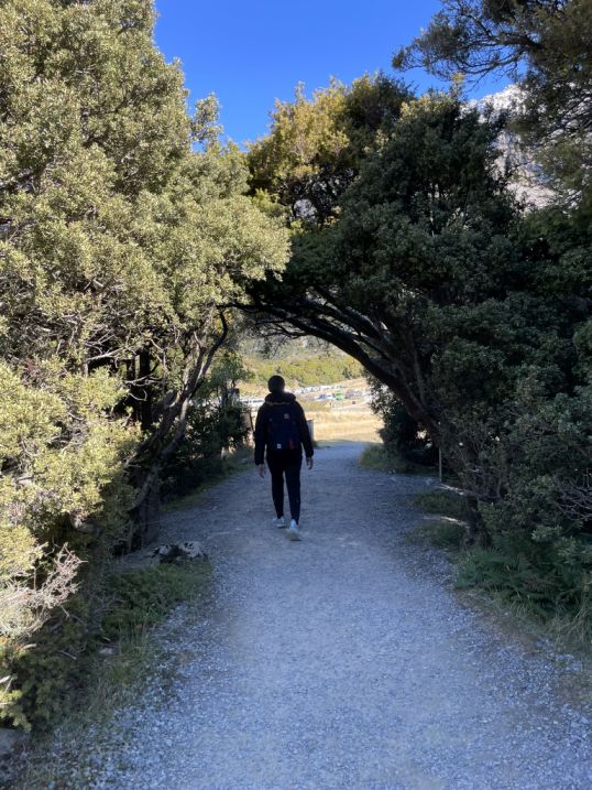 |
As we got near the end of the Hooker Valley Track, the open alpine landscape begins to shift. The golden grasses and wide valley slowly give way to a more sheltered trail, where clusters of native trees and shrubs line the path.
The trail weaves through stands of mountain beech and low alpine bush, offering moments of dappled shade and the quiet rustling of leaves in the breeze. After the vastness of the valley, this enclosed section feels cozy and peaceful, like the final chapter of a long and beautiful story.
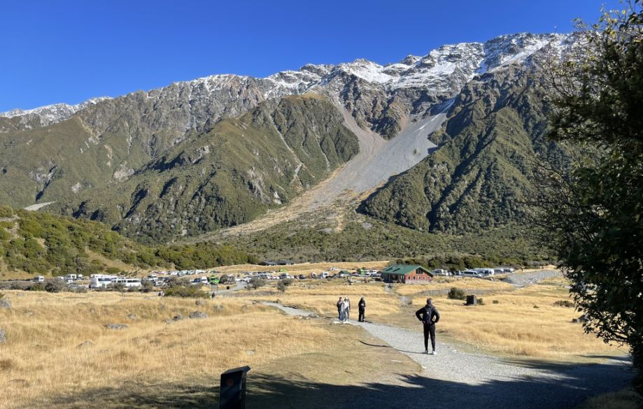
Then, through the trees, a clearing opens up, and you catch your first glimpse of the White Horse Hill campground and parking area.
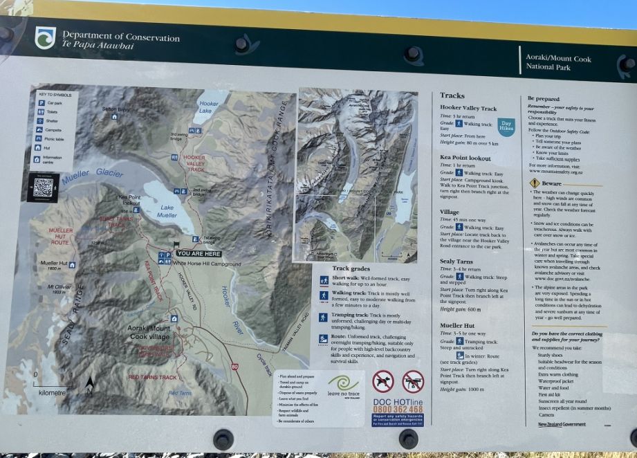
Map of the Hooker trail.
Completing the Hooker Valley Track feels like walking out of a dream and back into the world, refreshed, humbled, and deeply moved. From swinging bridges and glacier-fed rivers to vast alpine plains and towering snow-capped peaks, every step offered something breathtaking. The golden grasses, the crisp mountain air, and the ever-present view of Aoraki/Mount Cook made it a journey not just through nature, but through awe. As you reach the end, there’s a quiet sense of accomplishment, and the feeling that you’ve witnessed something truly timeless.
NEXT... Blue Lakes trail