Three weeks in New Zealand - 4/12 - 5/4/2024
Day 17-Drive to Mount Cook-4/27/2024
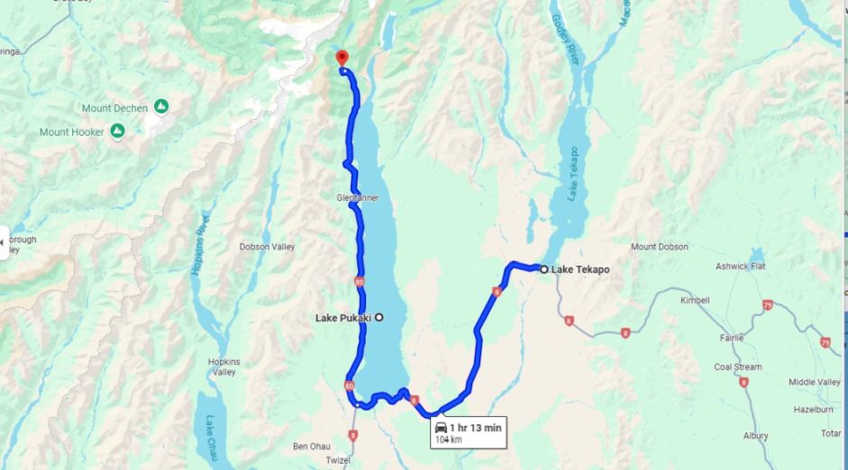
After Lake Tekapo we drove to Mount Cook but we stopped by Lake Pukaki first.
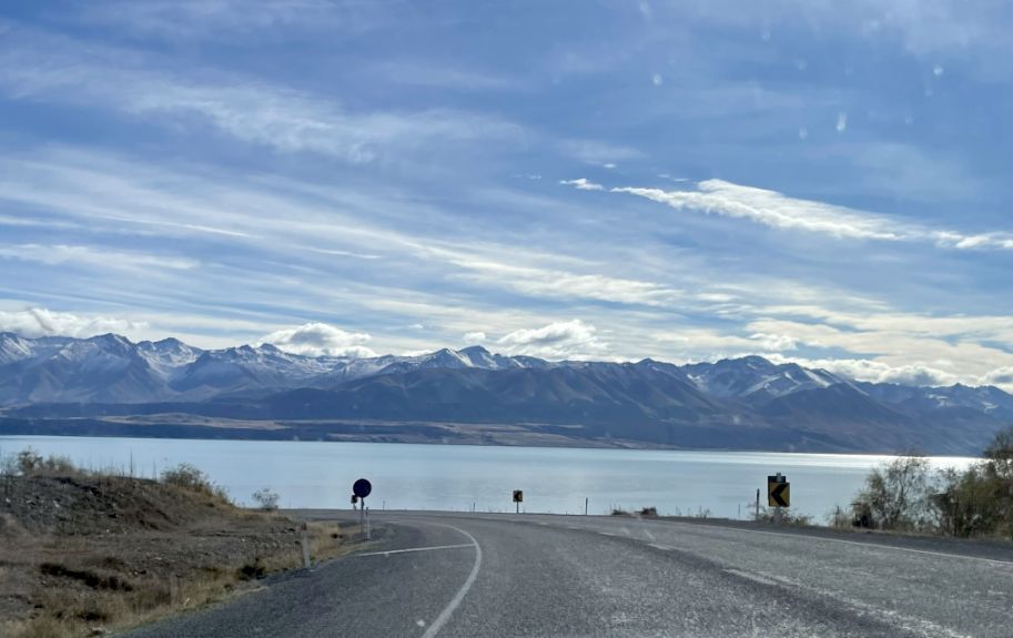
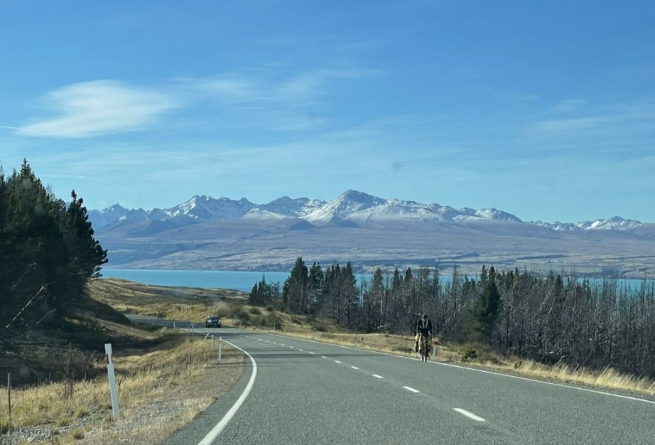
The drive from Lake Tekapo to Lake Pukaki is one of the most scenic stretches in New Zealand with open skies, golden plains, and a continuous backdrop of towering Southern Alps.
As we left Lake Tekapo behind and headed southwest along State Highway 8, the landscape begins to widen. The flat, golden tussock plains of the Mackenzie Basin stretch out in every direction, framed by the snow-dusted peaks of the Southern Alps.
Ahead of us is the stunning blue of Lake Pukaki.
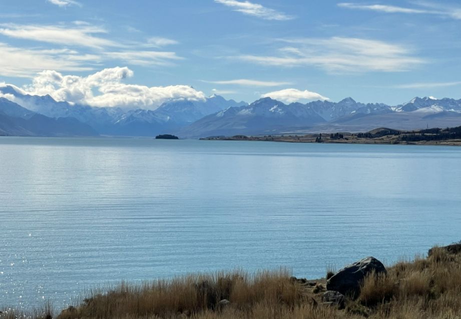
Blue steel lake with the Aoraki/Mount Cook standing perfectly aligned at the far end of the lake, towering over everything like the guardian of the land.
What a beautiful scenery.
The store of the lake is filled with golden grassland.
The view here of Lake Pukaki is so serene.
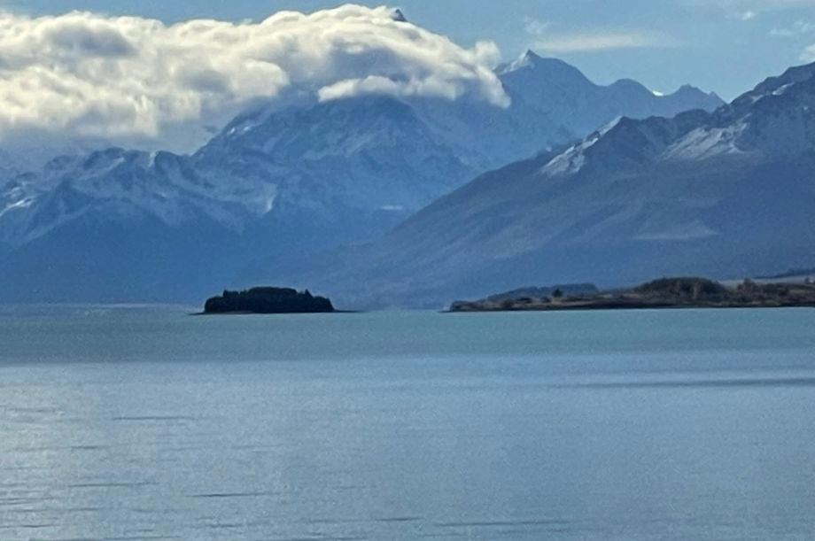
In the distance is a small rocky island located in the southern part of the lake, closer to the Tekapo–Twizel Road (State Highway 8). The island is named Motuariki is Māori. Motu means island, and ariki can mean chief or leader. In very calm weather like today, it can appear like it’s floating on the turquoise water.
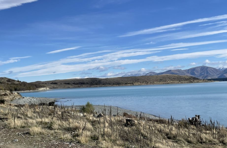
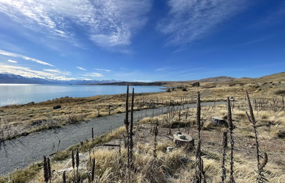
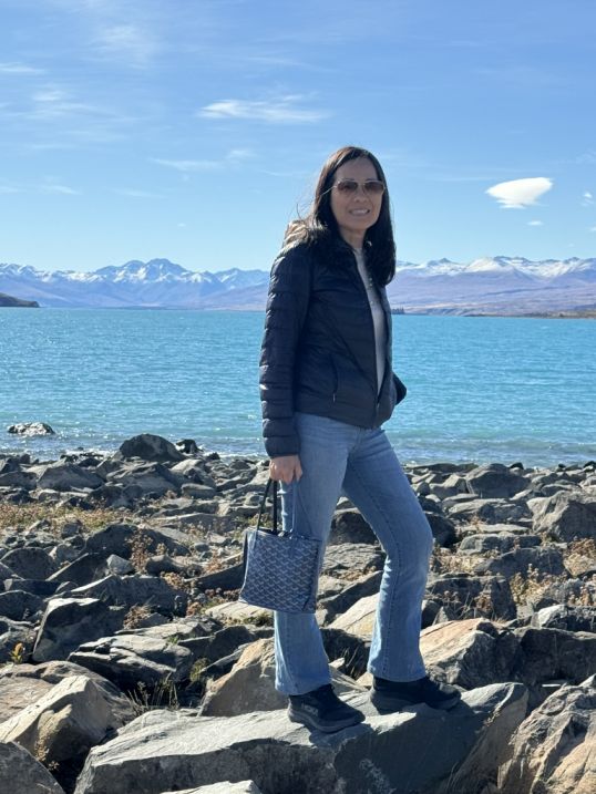
Shore of Lake Pukaki
We’re standing at the edge of Lake Pukaki, where the land feels both wild and wide open.
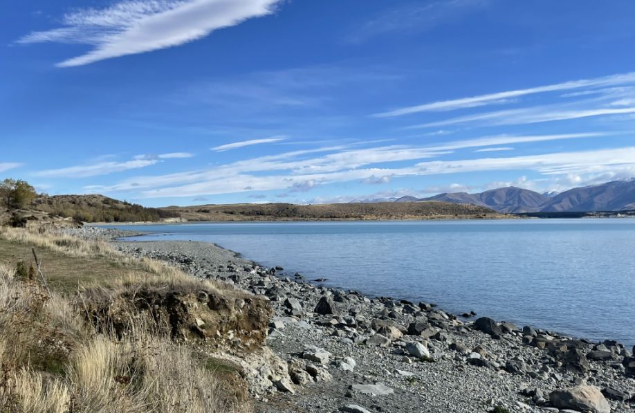
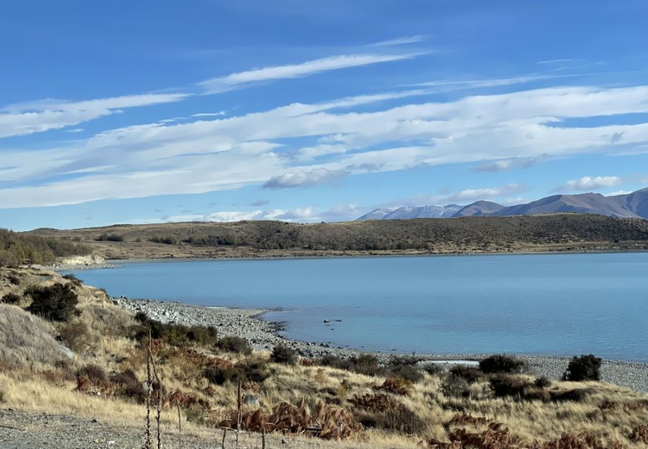
The shoreline is rugged, scattered with weathered rocks.
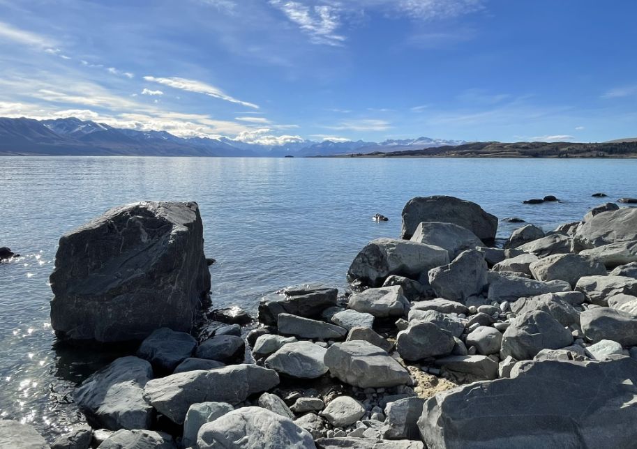
As we get close to the shore, massive grey boulders are sticking out of the lake.
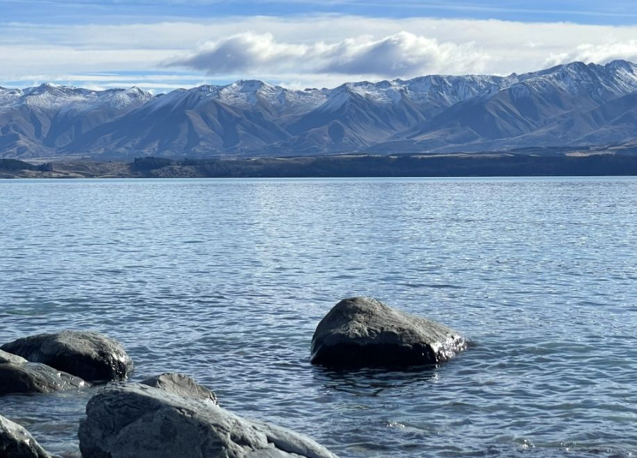
The water is still, a striking milky turquoise, like melted ice, and straight ahead is the Southern Alps that rise in jagged layers with snow-capped is simply majestic.
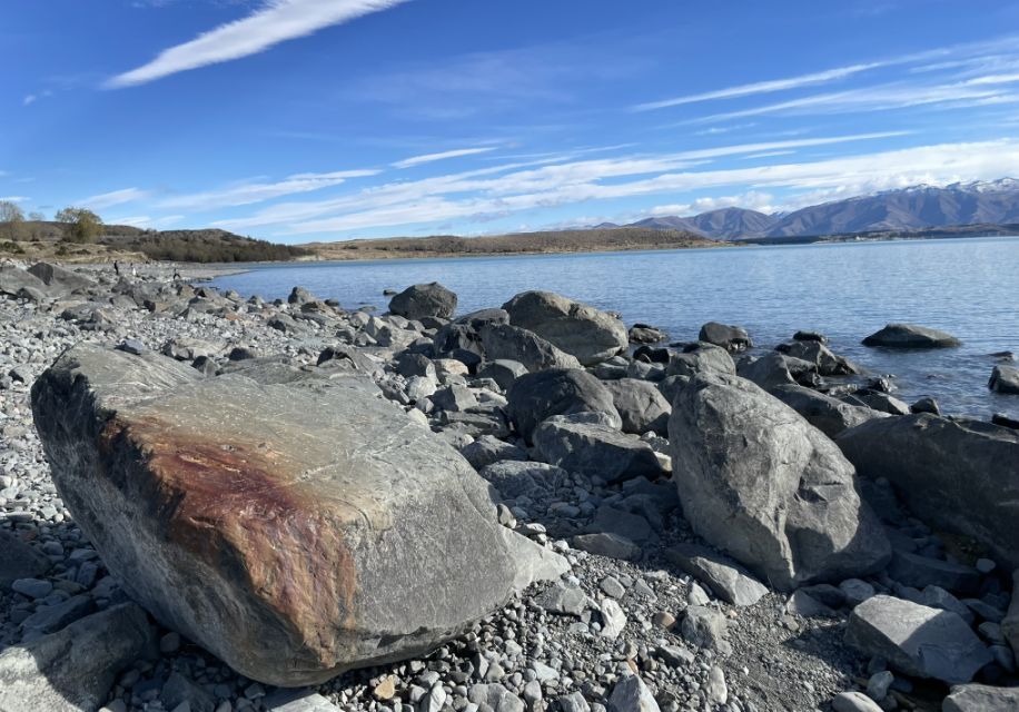
Some of the boulders are half-buried on the shore and in the lake, others stacked as if placed by glaciers long gone.
 |
 |
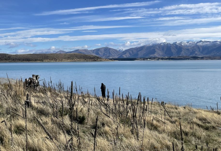
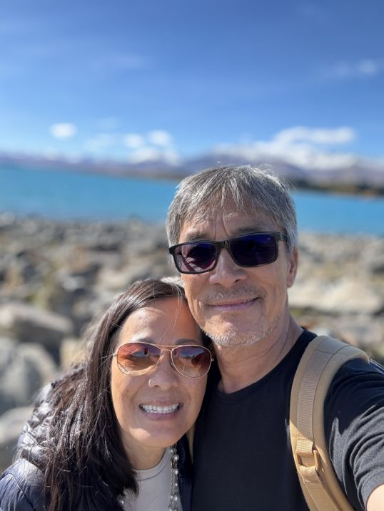
A beautiful day on the shore of Lake Pukaki
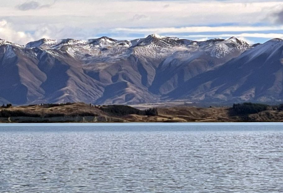
View of the lake and the mountains range towering over the lake.
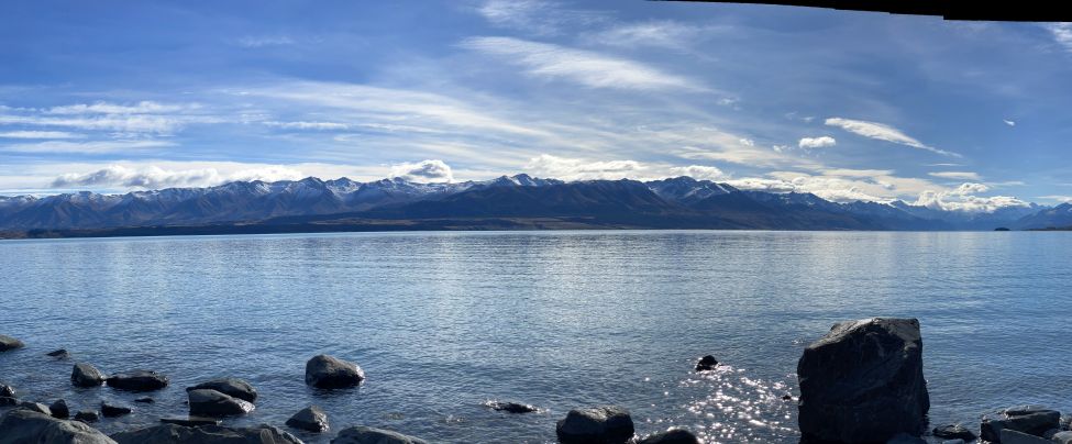
Panoramic view
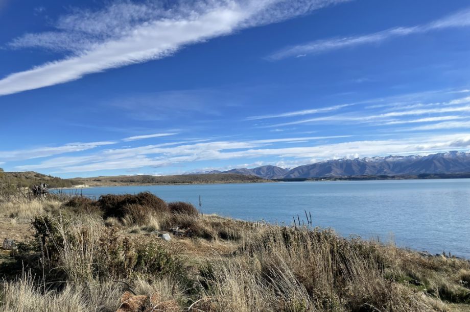
On the shore of Lake Pukaki, you get to see golden grass moving in the wind, and snow-capped peaks across the glacier-blue water.
 |
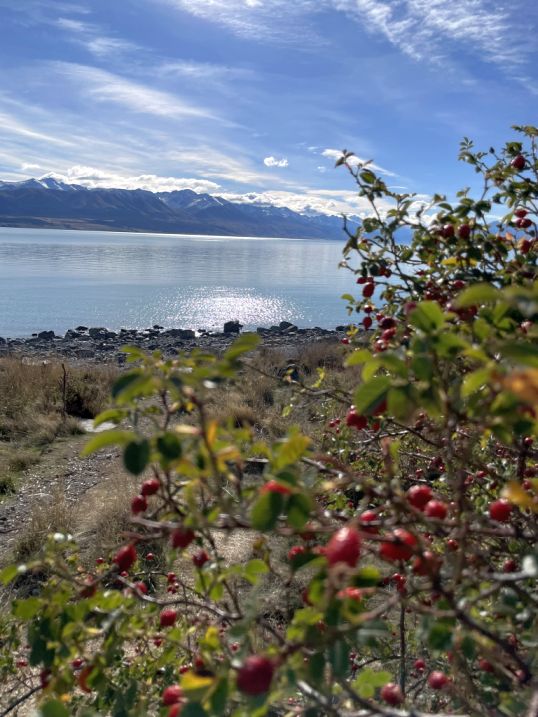 |
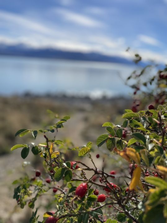
The small, round fruits that appear on the rose bush at the end of the growing season are called rose hips. The hips mature after the first frost in late summer or early autumn, although they are often harvested and used in a variety of ways, leaving the hips on the plant provides color and texture for a winter landscape.
One last look at the Lake and we are heading back to our car.
We are now driving away and heading to Mount Aoraki.
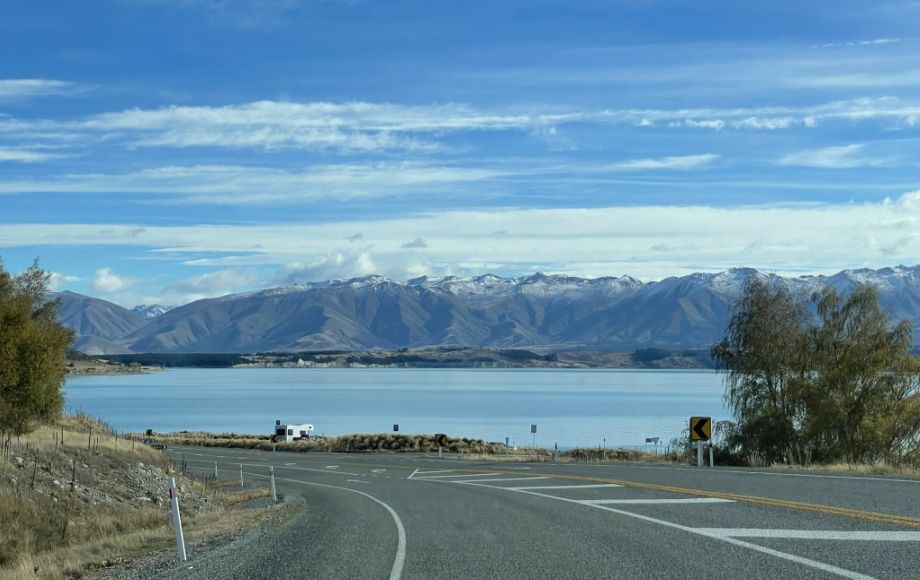
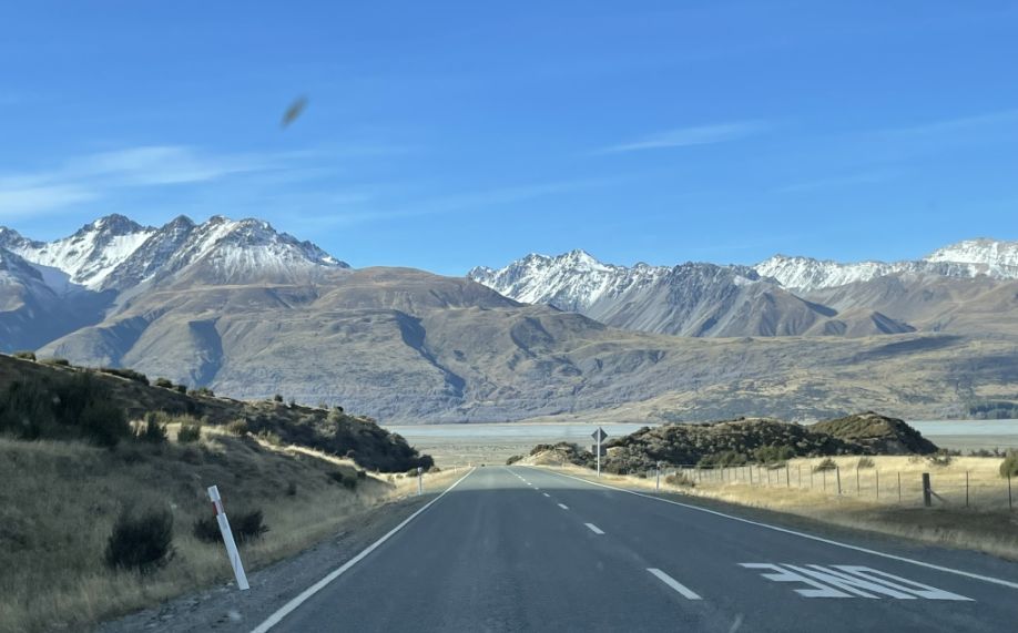
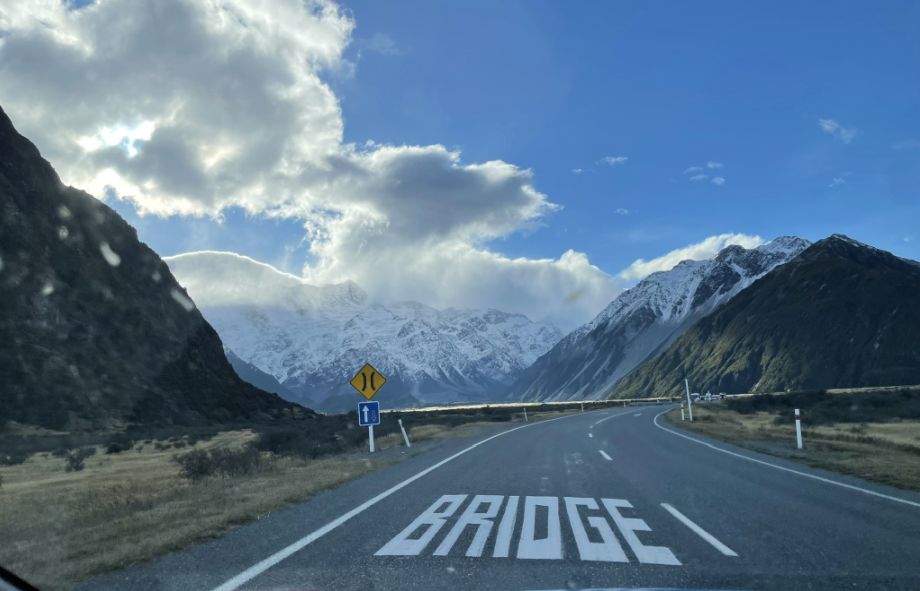
We took Mount cook Road from State Highway 80 and the view is so scenic.
Leaving the rocky shore of Lake Pukaki, we turned onto Mount Cook Road, a long ribbon of highway that hugs the lake’s western edge.
Almost immediately, the landscape shifted and ahead, the mountains began to rise, taller, sharper, more dramatic with every mile.
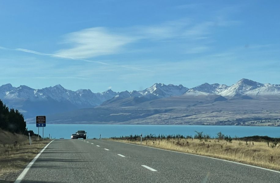
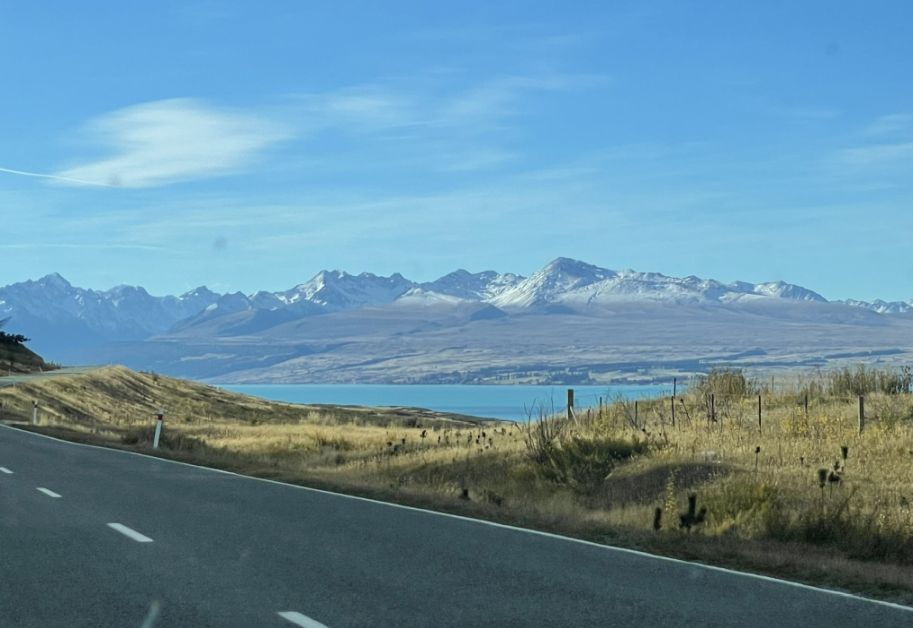
Lake Pukaki is one of the largest alpine lakes in New Zealand, about 17 miles long and a width of 5 miles with a surface area of 69 square miles). Its bright turquoise color comes from “glacial flour”, tiny rock particles ground down by glaciers, suspended in the water and reflecting light.
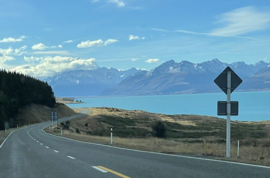
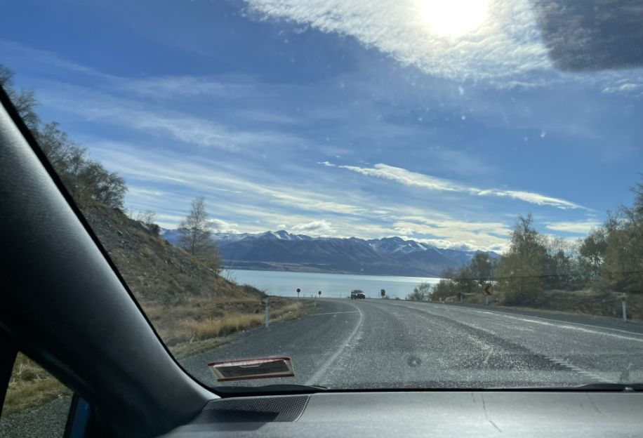
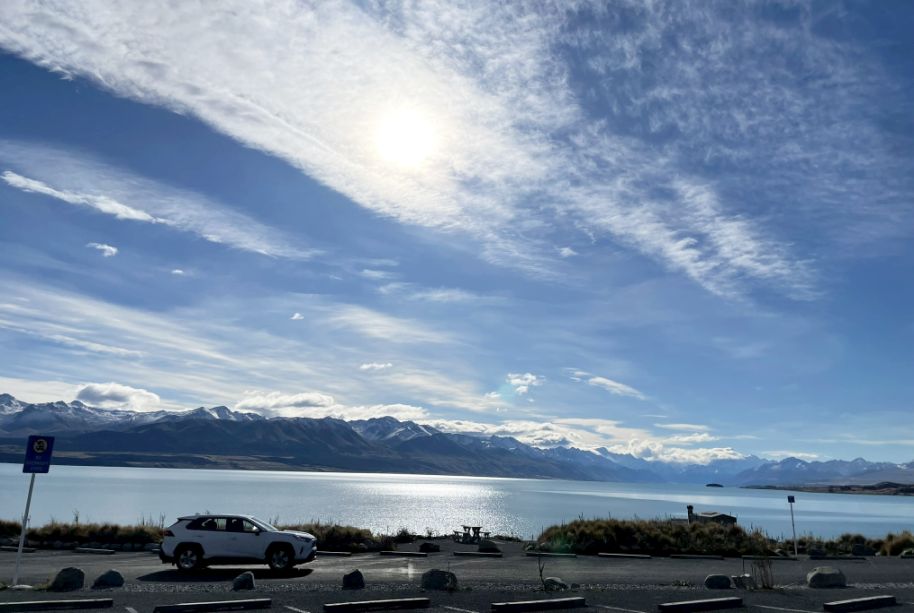
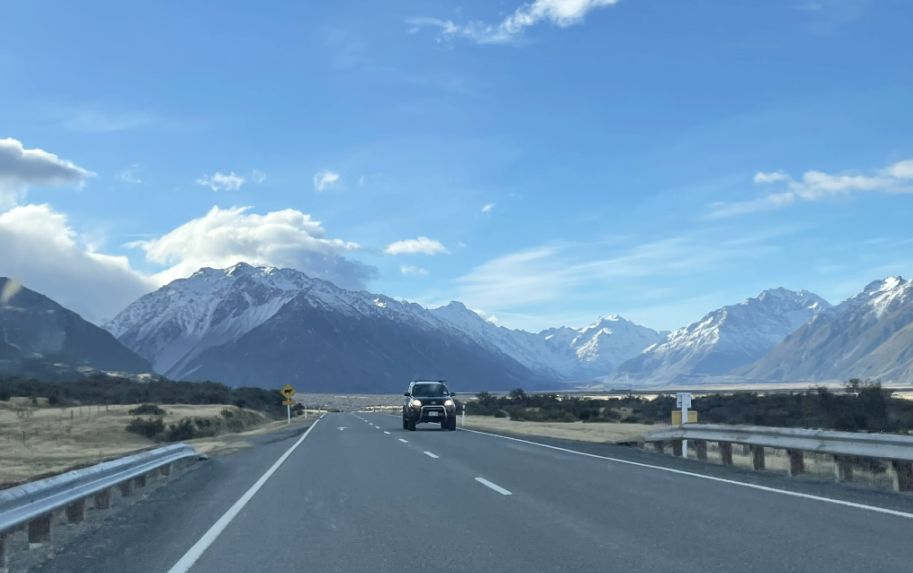
We are on Highway 80 on Mount Cook Road, a stunning drive that winds along the western shore of Lake Pukaki.
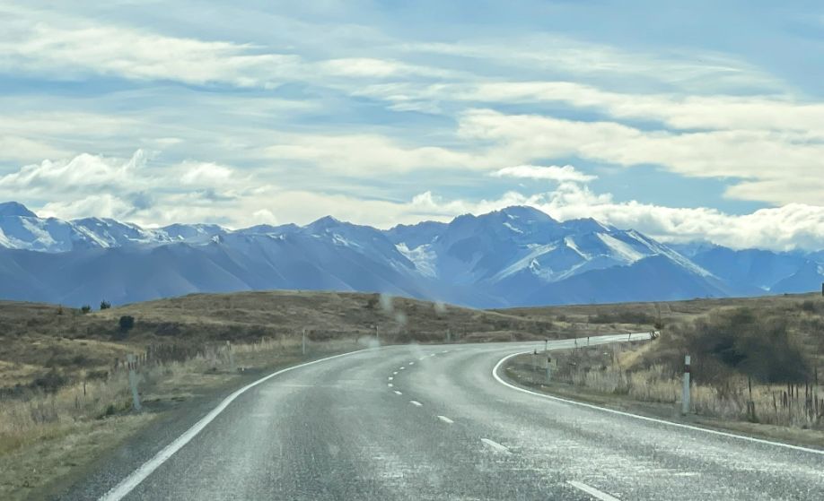
Ahead, the Southern Alps is rising dramatically, with snow-capped peaks growing larger as you approach Mount Cook.
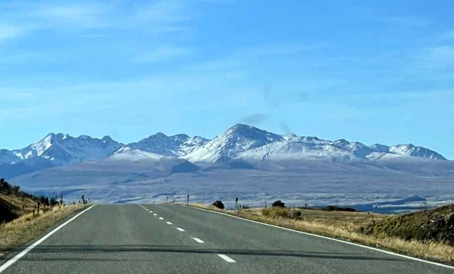
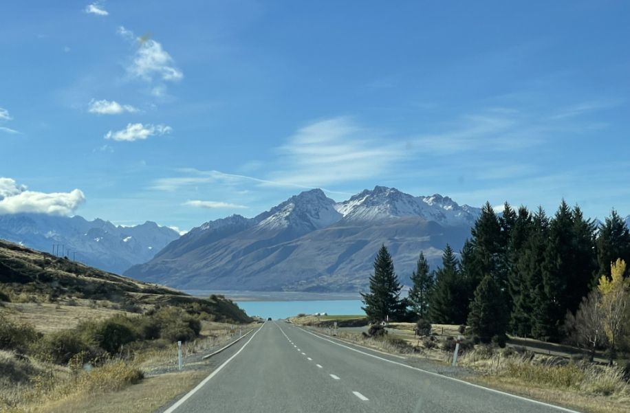
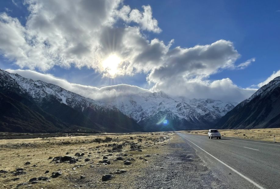
We are now driving inland and we drove by layers upon layers of mountains.
As we continue on, we are getting deeper into heart of the Southern Alps, with Aoraki/Mount Cook growing more majestic in the distance.
The rugged mountains with their peaks dusted with snow.
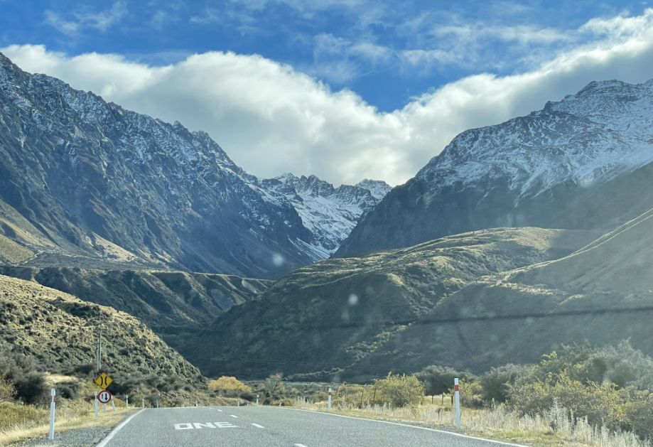
We are beginning to gently climb Birch Hill which is not a steep mountain, but rather a gradual rise in the landscape, and part of the rolling terrain that shapes the Mackenzie Basin.
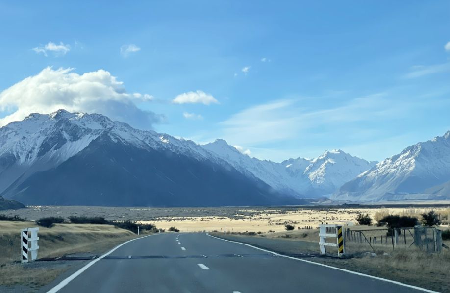
The road here slowly gains elevation as it moves inland from Lake Pukaki, curving with the contours of the land, and we are surrounded by open grasslands.
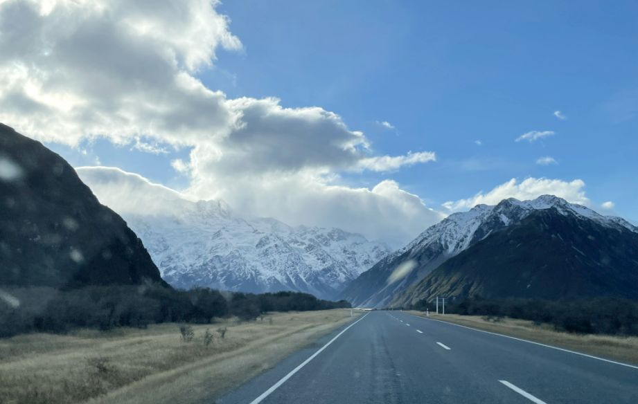
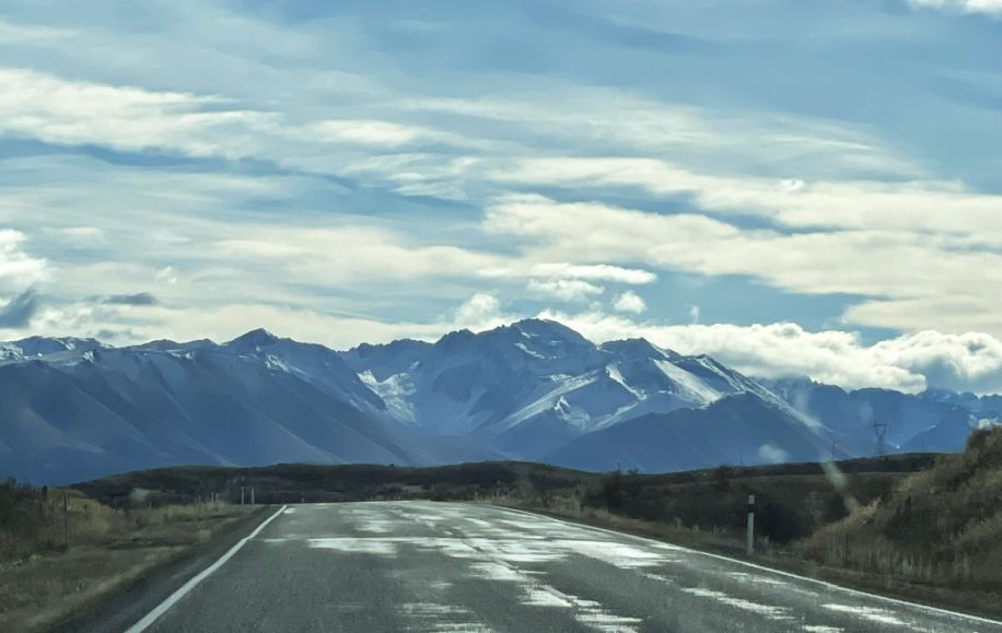
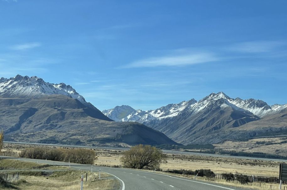
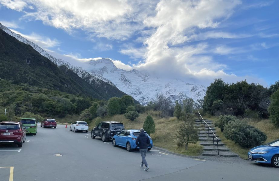
The road runs straight toward the mountains and we are deep in Aoraki/Mount Cook National Park. That huge snow-covered mountain ahead is the Aoraki/Mount Cook.
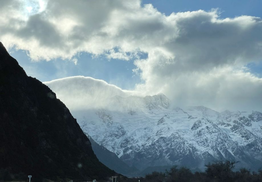
Aoraki/Mount Cook is the highest mountain in New Zealand, reaching 12,218 feet into the sky. It’s part of the Southern Alps/Kā Tiritiri o te Moana, the dramatic mountain range that forms the spine of New Zealand’s South Island.
The mountain rises sharply from the surrounding valleys and capped in snow.
Today, Mount Cook is a symbol of natural beauty and adventure. It draws climbers, hikers, and nature lovers from around the world. Sir Edmund Hillary trained here before hiking/climbing Everest.
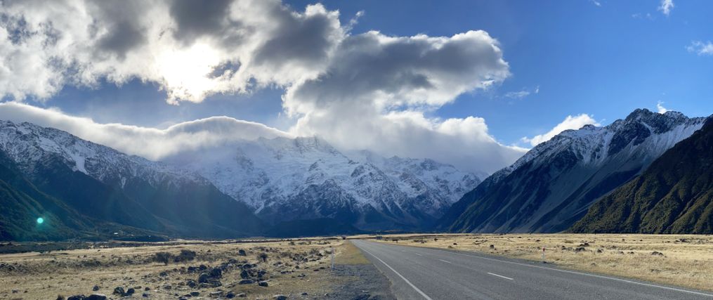
Panoramic view.
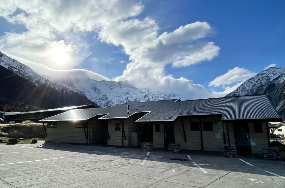
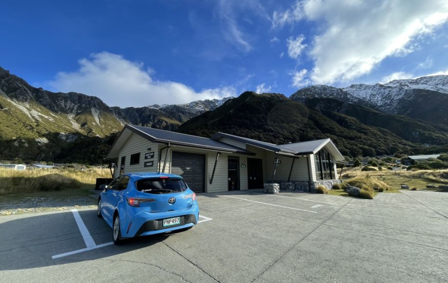
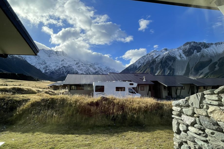
We are now at Aoraki court Mount Cook Village. This is the office and we stopped by to pick up our key.
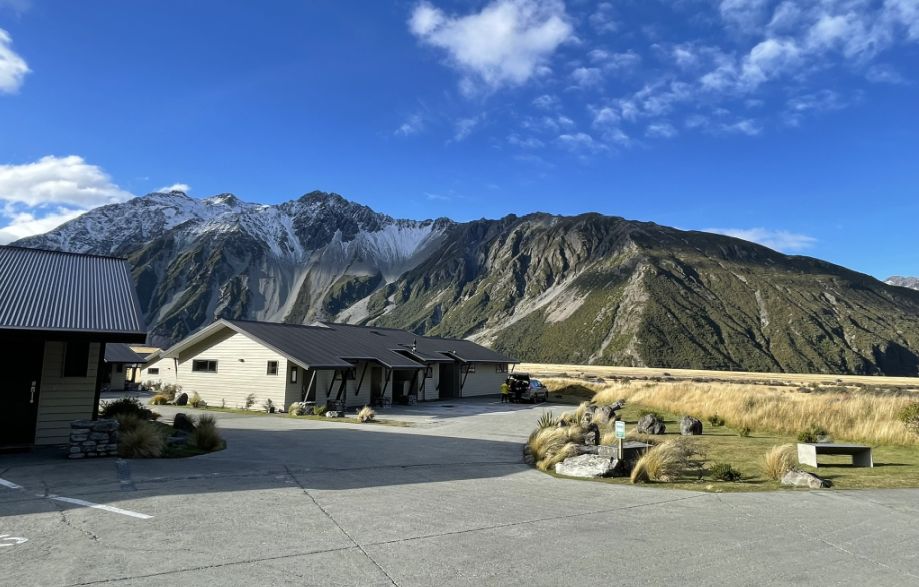
View of the surrounding as I am standing on the ground of the Aoraki court Mount Cook Village.
We parked our car and our cottage is the one of the left.
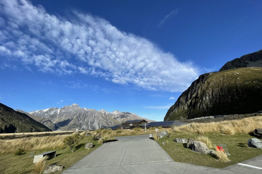
The landscape is so magnificent in this area.
 |
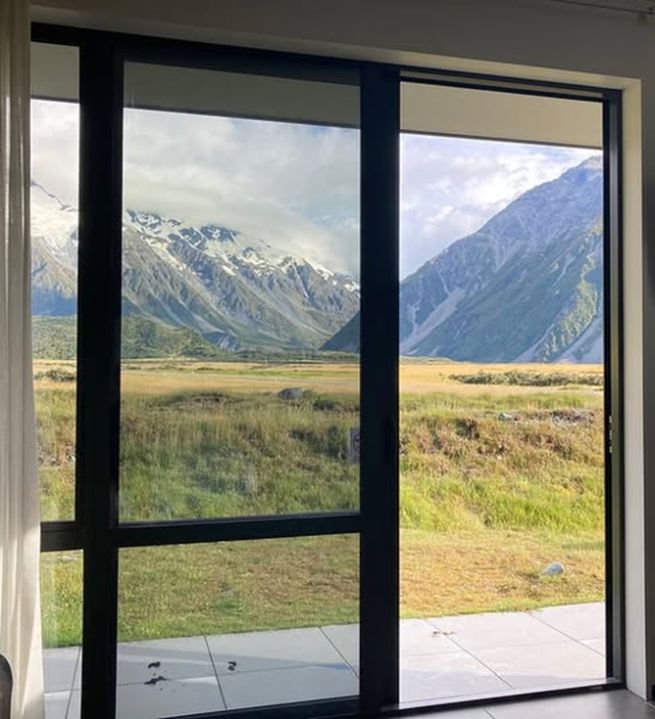 |
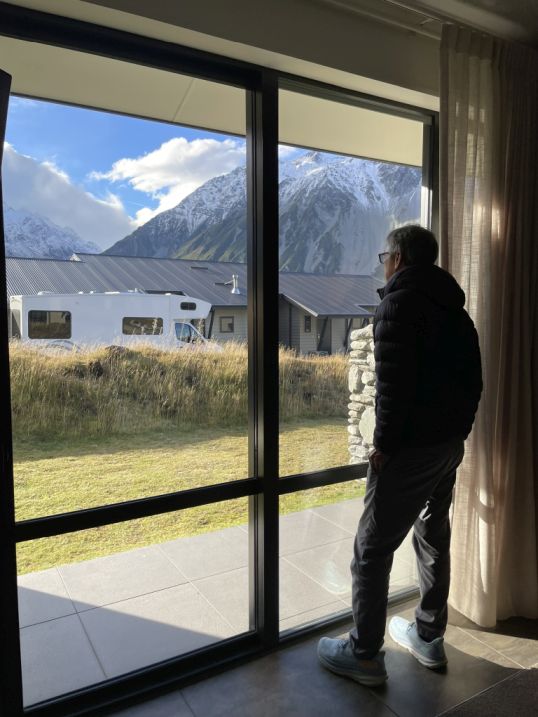
All the cottages face directly toward the dramatic mountains. Our cottage is really comfy and is actually quite roomy.
This is the patio from our cottage.
We are now headed to Hermitage hotel which is a 5 minutes walk from our cottage.
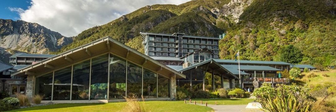
Panoramic view of the Heritage hotel, one of the first accommodation in the Aoki/Mount Cook National Park. The original Hermitage was built in 1884–85 by Frank Huddleston, a surveyor and ranger, using cob materials near White Horse Hill at the base of Mueller Glacier. It offered just 11 guest rooms and rustic accommodation for early climbers and explorers. The current building dates from 1958 and the main part of Mount Cook Village. The hotel, along with a lodge and motel complex also owned and operated by the Hermitage, and forms the main part of Mount Cook Village, with the hotel being the only large building in the area. The current site, slightly elevated on the side of the valley, was chosen in 1913 for its unimpeded views of Aoraki / Mount Cook and Mount Sefton.
NEXT... Dinner at the Panoramic Room